The First Documented Electric Scooter Crossing of Vietnam
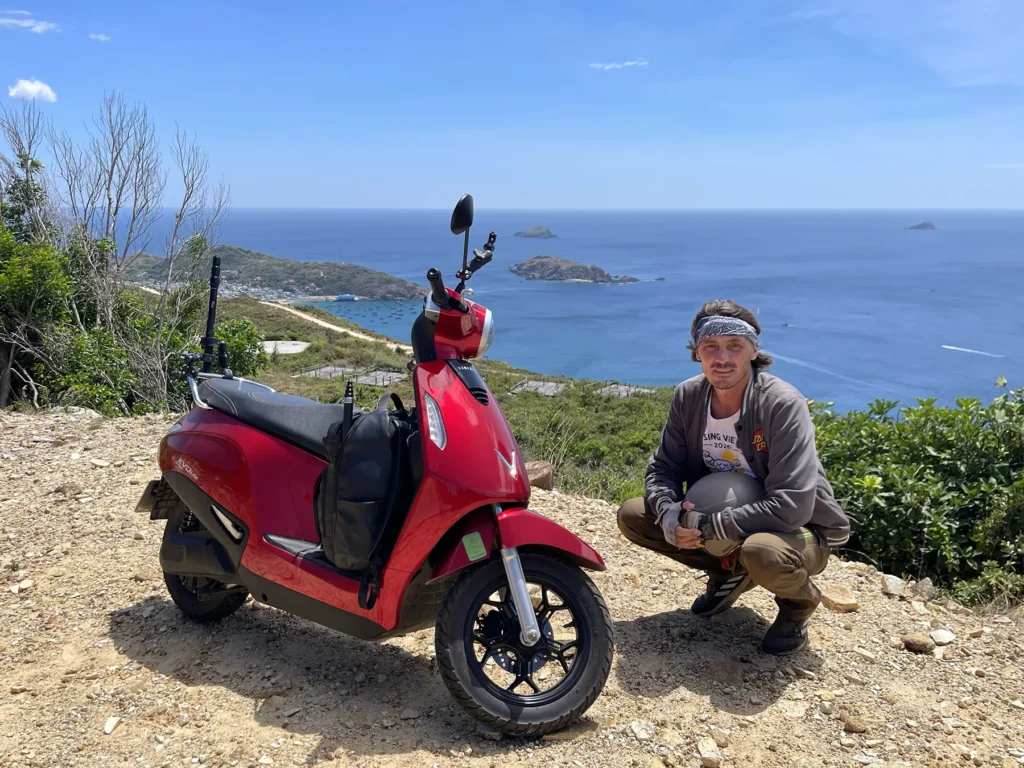
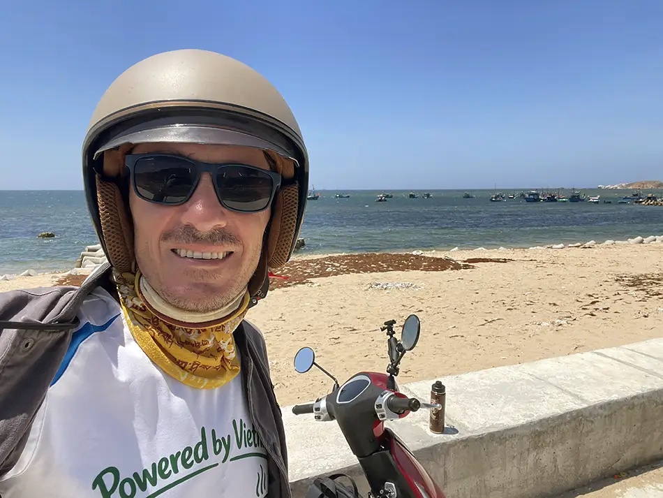
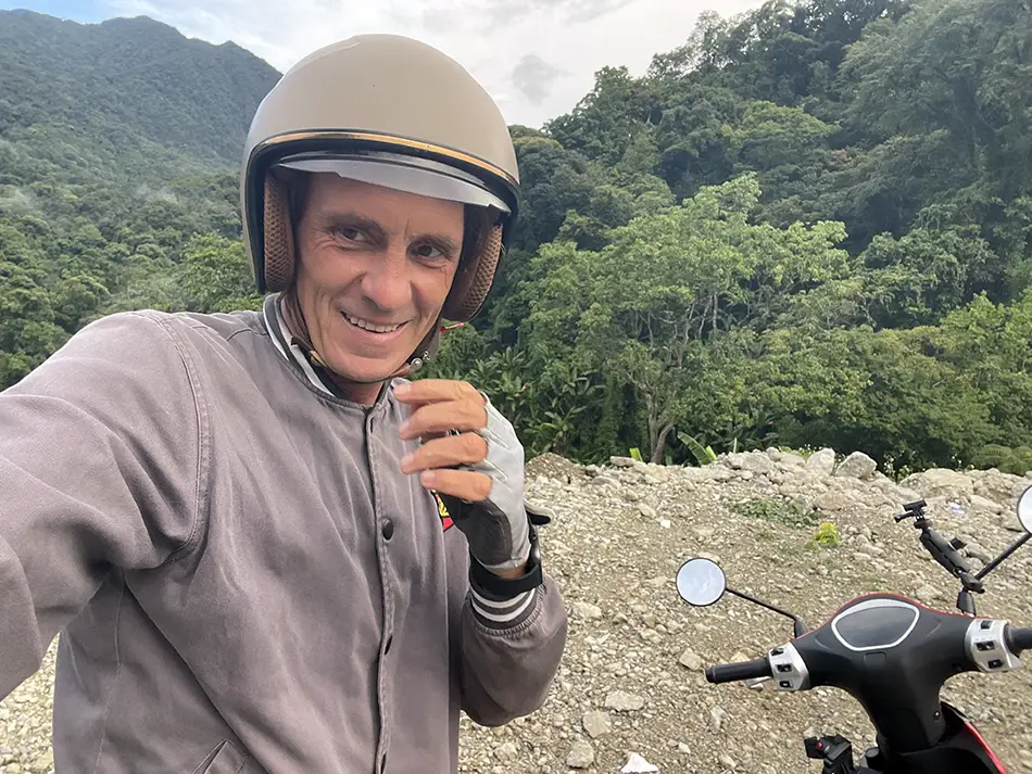
Hi, my name is Yuri Malykh. I have been traveling for ten years, and I was foolish enough to test whether it is possible to legally cross Vietnam without a driver’s license and without harming the environment through exhaust gases. To find out, I bought a brand-new electric scooter and set off to ride across the country from its southernmost tip all the way to the far north.
According to public data, a Vietnamese traveler completed a major cross-country trip nine years ago, which is amazing. However, his route was shortened: he rode from the easternmost point to the southernmost tip, skipping the hard-to-reach northern mountains. That traveler covered the country in 9 days via highways, proving that electric vehicles are viable for long trips. My goal is different: I decided to go all out and travel true edge-to-edge.
I set off thinking this might be the first complete journey of its kind. Yet I am not looking for a pioneer’s crown; I just want to show thousands of curious travelers a completely new way to explore this country, while respecting its laws and taking care of its environment. That is why I plan to stay off major highways as much as possible, taking back roads to soak in the full aesthetic joy of slow travel.
Here is how it all turned out…
Mission Complete — 27 June 2026
Route: 📍Mũi Cà Mau → 📍Điểm cực Bắc của Việt Nam
Vehicle: VinFast Evo Lite (2026) — license-free
Total distance | 4,187 km (2,602 mi) |
Calendar days | 31 |
— Riding days | 21 |
— Exploration days | 2 |
— Rest days | 8 |
Battery swaps | 102 |
Total fuel cost | $35 USD |
Total trip spend (without the rest days) | $460 USD |
What follows is the full account of the project — from buying the scooter and the two-day ride south to the starting point, through 23 active riding days across the country, mostly on small regional and provincial roads.
Fishing villages, Khmer temple corridors, Mekong Delta ferries, the karst formations of Ninh Bình, the Ho Chi Minh Highway through Kon Tum, the Mã Pí Lèng Pass.
The road wasn’t without adventure.
There were coastal stretches where the mountains meet the sea, karst plateaus, rice terraces the colour of gold before the harvest. Khmer temple ceremonies I stumbled into, mudflat fishing at low tide, tomb-cities on the peninsula near Huế, ethnic villages on stilts above the water.
There were mechanical failures — an overheating scooter on mountain climbs, a broken sensor after a low-speed fall, a battery that died in 47-degree heat.
There were natural obstacles — storms in the mangroves, floods that turned streets into rivers, heat that turned the road into a griddle.
And a lot of small human moments… All of it is in the pages below.
Table of Contents
Preparation Start — May 14, 2026
Getting the Ride
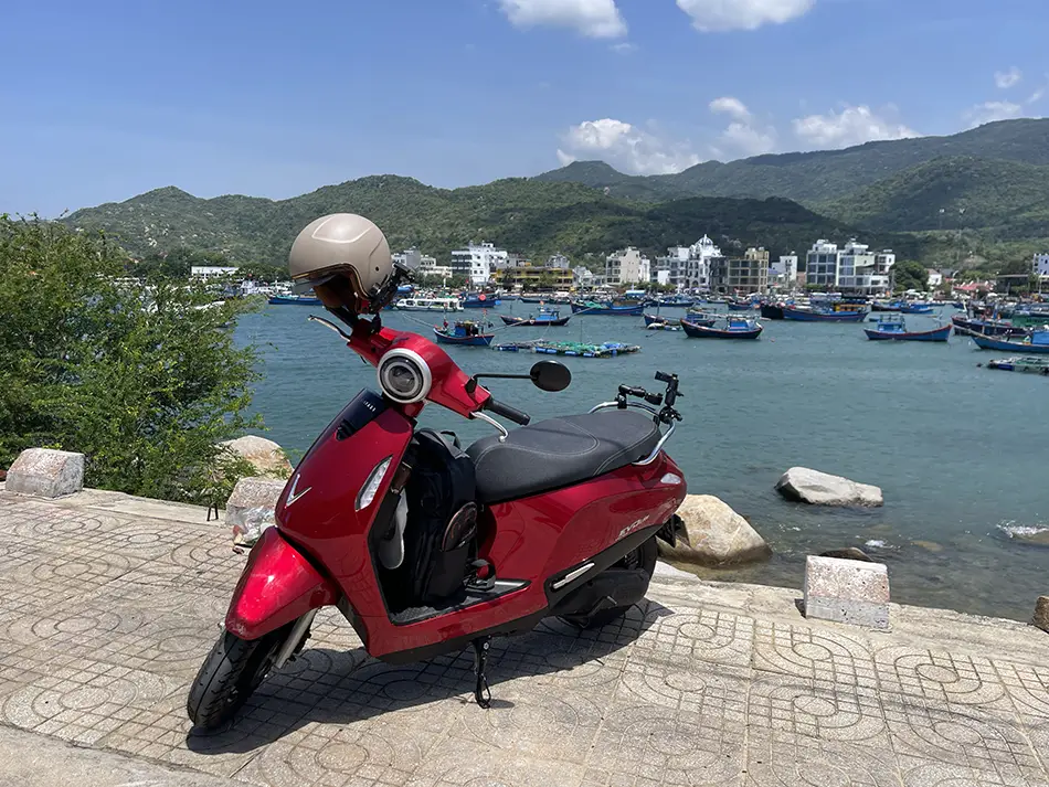
Every motorcycle trip has one non-negotiable starting point: you need a motorcycle. Obvious, sure. And yet finding the right one ended up being the biggest part of this whole preparation process.
The main constraint I was working with: whatever I ride has to be something I can legally operate in Vietnam without a motorcycle license. That narrows things down quite a bit. After going through the available options and doing the usual agonizing over specs I only half understand, I landed on the Vinfast Evo Lite — a brand-new model released just this year.
What makes it stand out from everything else in the license-free category is one specific feature: it’s the first no-license scooter in Vietnam with a battery swap system. The bike runs on two batteries housed inside the frame. You can charge them the traditional way via cable, but you also have the option to pull into a swap station, hand over your dead batteries, and ride away with fully charged ones in minutes.
Vinfast claims there are already 45,000+ swap stations operating across the country. If that’s true in practice, the “range problem” that kills most e-scooter trips essentially disappears — it becomes roughly similar to stopping for gas on a petrol bike. Whether those stations are actually out there when I need them in the middle of nowhere is, frankly, one of the main things this whole trip is designed to find out.
Buying the Thing

I bought the Evo Max Lite (2026) brand new from a Yamaha dealership. The purchase itself was painless — under an hour, start to finish.
One thing anyone planning to do the same should know upfront:
Foreigners without a Temporary Residence Card (TRC) cannot register a vehicle in their own name in Vietnam. You need a trusted local friend willing to be the official owner on paper.
The breakdown:
- Bike price: ₫16,700,000 ( $634/ ~€540)
- Batteries: Not included — purchased or rented separately
- Battery deposit: ₫500,000 ( ~$19 / ~€16) per battery
- Monthly battery rental fee: ~$6.45 (₫170,000 / ~€5.50) per battery per month
There’s a small wrinkle: the dealership could only locate one battery at the time of purchase. They’re “working on finding the second one.” I’m choosing to believe them.
Getting the Plates
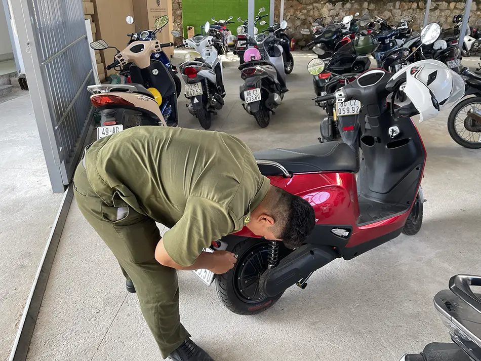
Here’s the mildly surprising part: even a license-free electric scooter needs to be officially registered and plated. The dealership is handling all the paperwork with the traffic authority — which is a relief, because bureaucracy in a language I don’t speak at all is its own kind of adventure I’d rather delay.
From the day of purchase, it took 14 days to get the official license plates on the bike.
Update on the battery
Unfortunately, I was unable to get a second battery. The seller simply told me they were out of stock. For the first week, they kept saying they were looking for one or had ordered it, but in the end, they just said, “Sorry, but that’s how it is—no battery.” We called other dealerships, and they all said the same thing: they do not provide second batteries.
It is definitely a strange situation. I personally saw dozens of scooters with identical, swappable batteries sitting right there in the distributor’s warehouse, yet they couldn’t rent even one of them to me.
600 Kilometers South: The Pre-Trip Journey
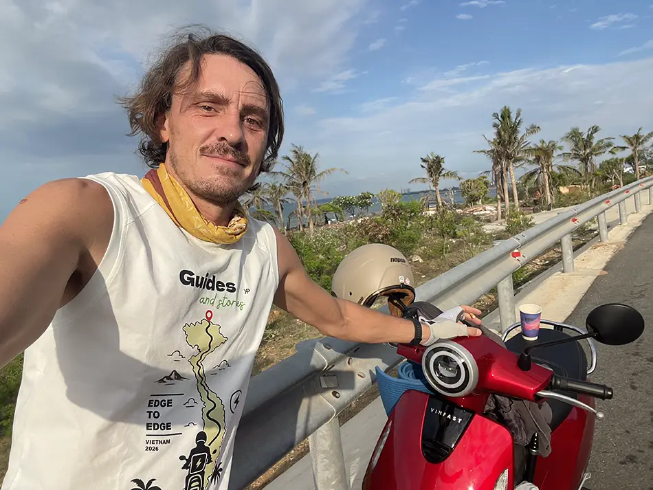
Before starting the official ride from the southernmost point of Vietnam to the north, I had to travel from 📍Mui Ne (Phan Thiet) to 📍Cape Ca Mau. This pre-trip distance is about 613 km (380 miles). The start was delayed by 4 days due to paperwork at the dealership, which took a full week. Once the police documents were ready, I got the license plate the next day and set off the following morning.
May 26 – Two Days Before the Official Start
The Numbers
- Distance driven today: 330 km (205 miles)
- Money spent today: 401,000 VND
- Route: Mui Ne to My Tho
- Road quality: 5/5
Road Journal
I departed at 6:30 AM. There were no major adventures planned for today—just driving down the highway. My main goal was to cover as much ground as possible while testing the real-world battery range under my actual weight and checking the density of the battery-swapping stations along the route.
Tested Battery Ranges:
Sport Mode [Max speed 49 km/h (30 mph)]: The battery lasts for 42–50 km (26–31 miles).
Eco Mode [Max speed 32 km/h (20 mph)]: The battery lasts for 65–70 km (40–43 miles).
After figuring out these ranges, I initially planned to use 50% of the battery in Sport Mode, and then use the app to find the nearest swapping station. By the third swap, I realized this strategy did not work.
I stopped for a coffee after using half the battery, checked the map, and realized I had been driving too fast. The nearest station was too far to reach, even if I go Eco Mode for the rest of the way. I had to ask the café owner to let me plug in the scooter using my portable charger. Ended up resting in a hammock for an hour and a half while the bike charged enough to help me reach the next station.
As it turned out, this was the only time I ever had to use my personal charger. Once the main part of the expedition kicked off, I made it a strict rule to rely solely on public swapping stations, and on my way north, I ended up leaving the portable charger behind with friends.
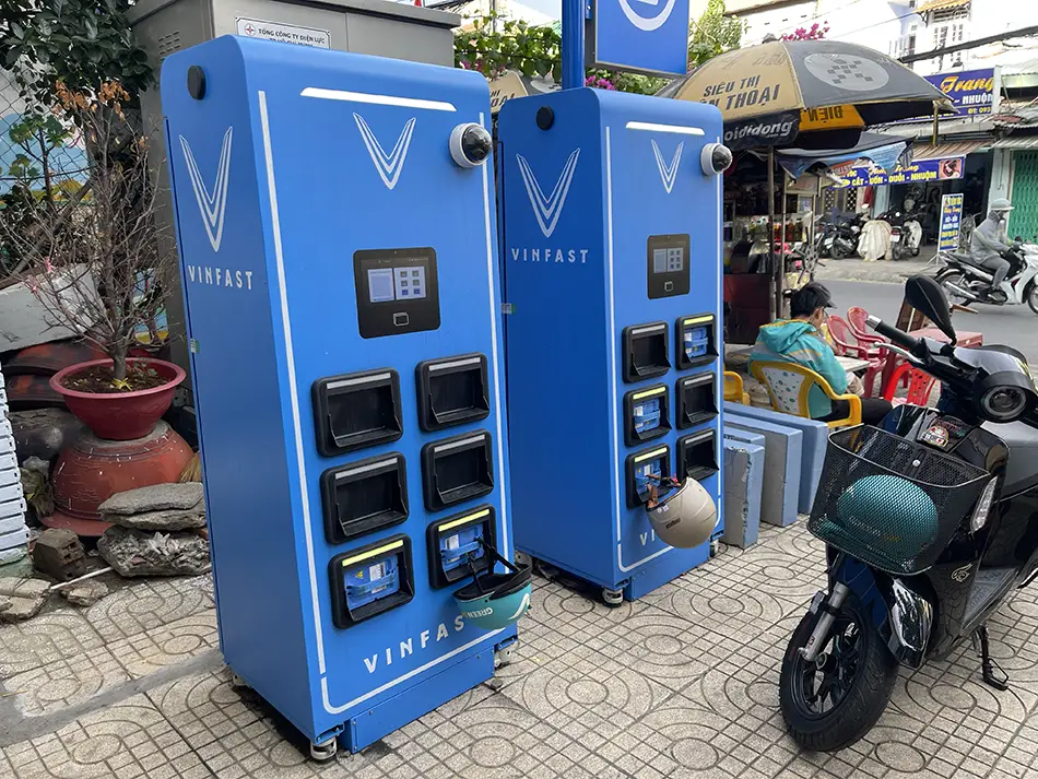
The battery queue
The second challenge happened in Ho Chi Minh City. Surprisingly, the density of swapping stations there was almost the same as on the highway, but the demand was much higher.
Local motorbike taxi drivers taught me the local etiquette for battery queues: when you arrive at a swapper, the screen shows the charge level of the batteries inside. You select the one closest to 100%, hang your helmet on the battery handle to reserve it, and wait for it to finish charging. According to the drivers, the batteries charge at a rate of about 1% per minute, though it felt slower to me.
I finally reached the city of My Tho after dark, covering a total of 330 km (205 miles) for the day. Considering the mistakes made, this is a good result for a scooter limited to 49 km/h (30 mph). Most importantly, I managed to avoid staying overnight in Ho Chi Minh City, which is too loud and doesn’t fit the vibe of this trip.
May 27 – One Day Before the Start
The Numbers
- Distance driven today: 402 km (250 miles)
- Money spent today: 416,000 VND
- Battery swaps made: 9
- Route: My Tho to Dat Mui Commune (Cape Ca Mau)
- Road quality: 3/5
- Scenery: 4/10
Road Journal
The day started at 6:30 AM leaving My Tho. The first 180 km (110 miles) along highway QL1 were straightforward, passing local shops, houses, and hammock cafés.
To prepare the scooter for the official start photos tomorrow, I stopped for a full wash (30,000 VND). Ironically, less than a kilometer later, the asphalt ended and turned into dusty gravel.

The Kickstand Sensor Breakdown
Around sunset, I stopped to take photos in a scenic spot with dried, cracked earth. While I was setting up, the scooter fell over onto its left side. Fortunately, my 360-camera caught on the selfie stick just 5 cm from the ground, leaving the bike with only a bent brake lever and a scratched mirror.
However, the impact damaged the side-kickstand sensor. On modern scooters, a safety feature prevents the motor from starting if the kickstand is down. For 30 minutes, I tried resetting it, adjusting the wires, and even using a pocket screwdriver to trigger the magnetic sensor, but the bike remained completely unresponsive.
With the nearest town 5 km (3 miles) away, I began pushing the bike. Within minutes, two locals stopped and offered to push me—a common technique in Vietnam where a rider uses their leg to propel another moving bike. They pushed me all the way into town to a small repair shop that specialized in electric scooters (surprisingly). The mechanic managed to disconnect and adjust the sensor, getting the bike running again. He refused to accept any money for the help.
Shortly after leaving to swap my battery, the sensor failed again. I pushed the bike back to the same shop. After the second repair, I asked the mechanic for a strong magnet to keep in my pocket, ensuring I could manually activate the sensor if it failed again on the road.
Riding through a Storm

As I approached the southernmost cape, the streetlights and houses disappeared, replaced by dark mangrove forests. A heavy downpour with lightning started, forcing me to pull under the awning of a roadside building.
The owner, a 65-year-old Vietnamese man, invited me inside. When I told him I was from Russia, he welcomed me warmly, insisting I join his friends for dinner. I used a translation app to talk with them while they shared pork and duck dishes. They strongly insisted I stay the night due to the storm, but because of previous delays on this expedition, I politely declined and continued toward the starting point once the rain slowed down.
The Final Stretch
With the battery running low, I switched to Eco Mode, cruising at a steady 32 km/h (20mph) down empty roads in complete darkness. The landscape was surreal, passing a massive Buddha statue on one side of the road and a Catholic church with illuminated crosses on the other. I arrived in a completely quiet, empty town near the national park. Fortunately, the battery-swapping station was working, allowing me to get a fresh 100% battery.
The hotel owner then messaged me: “My friend, you won’t find the hotel easily, it is hidden.” Following his maps, I turned off the main road onto a narrow concrete path through the mangroves, navigating past barking dogs. The path eventually narrowed into a one-meter-wide concrete bridge with water on both sides and no railings.
I finally reached the property at 11:00 PM.
Tomorrow, the actual expedition begins.
Day 1: Cape Ca Mau → Ca Mau City — The Official Start
May 28, 2026
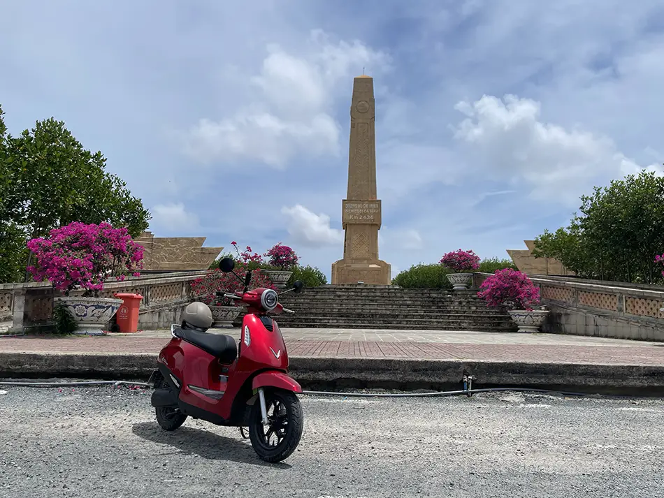
| Start: 📍Cape Ca Mau | Finish: 📍Ca Mau City |
|---|---|
| Distance | 135 km (84 mi) |
| Total distance | 135 km (84 mi) |
| Battery swaps | 3 |
| Spend | 529,000 ₫ (~$20.11) |
| Road quality | 3/5 |
| Scenery | 5/10 |
Road Journal
Finding a battery-swapping station just 15 km (9 miles) from Cape Ca Mau was a great surprise. This network is quite new, so having a station at the very end (or beginning) of Vietnam is excellent. It only had one full battery available, which might cause waiting times if more electric travelers come here, but it worked perfectly for me.
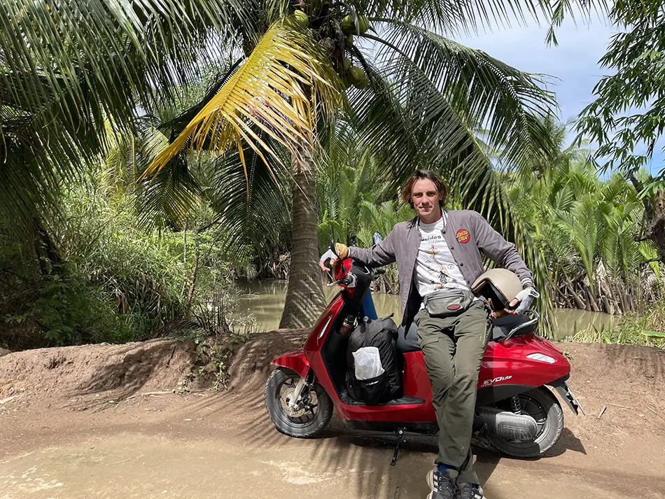
Leaving with a full charge allowed me to explore the route fully in daylight. The views are beautiful, with thick mangrove forests growing right next to the road. To see more of the local life, I turned off the main highway onto a quiet coastal side road. I passed through a small village where people live in houses built on stilts directly over the water. The locals were very friendly and waved at me as I rode by.
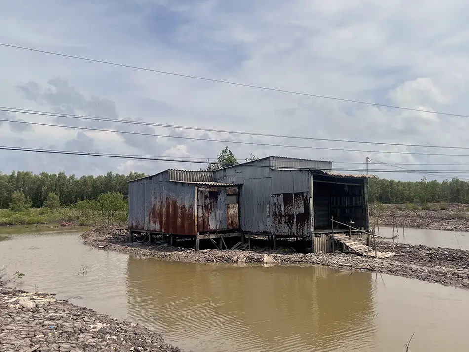
When the side road ended, I got back onto the main highway. On the way, I stopped by the house of the man who gave me shelter during yesterday’s storm. I bought a lemonade from him to say thank you, and then continued toward Ca Mau City.
The road to the city was good, with smooth asphalt and very few cars. I arrived early and finally got some good sleep. The stilt bungalow from the night before was a great experience, but the loud motorboats at 4:00 AM made it impossible to rest properly!
Day 2: One-Day Loop Around Ca Mau in the Mekong Delta
May 29, 2026

| Start: Ca Mau City | Finish: Ca Mau City (loop) |
|---|---|
| Distance | 181 km (112 mi) |
| Total distance | 316 km (196 mi) |
| Battery swaps | 4 |
| Spend | 465,000 ₫ (~$17.68) |
| Road quality | 4/5 |
| Scenery | 6/10 |
Road Journal
Day 2 of crossing Vietnam south to north on an electric scooter.
Today I tested whether a one-day loop around Ca Mau City (Cà Mau) works as a route — and it does. 181 km, four battery swaps, and the kind of variety that turns a city stopover into a destination.
The loop went west to Thi Tuong Lagoon (Đầm Thị Tường), the largest lagoon in the Mekong Delta, with restaurants directly on the water and the fishing industry visible all around. From there along the coast to the Ship to the North Monument (Tập kết ra Bắc) — a large memorial on an artificial pedestal in the sea, completely empty of tourists. As I was leaving, a local entrepreneur pulled up with homemade electric carts he rents for driving around the area.
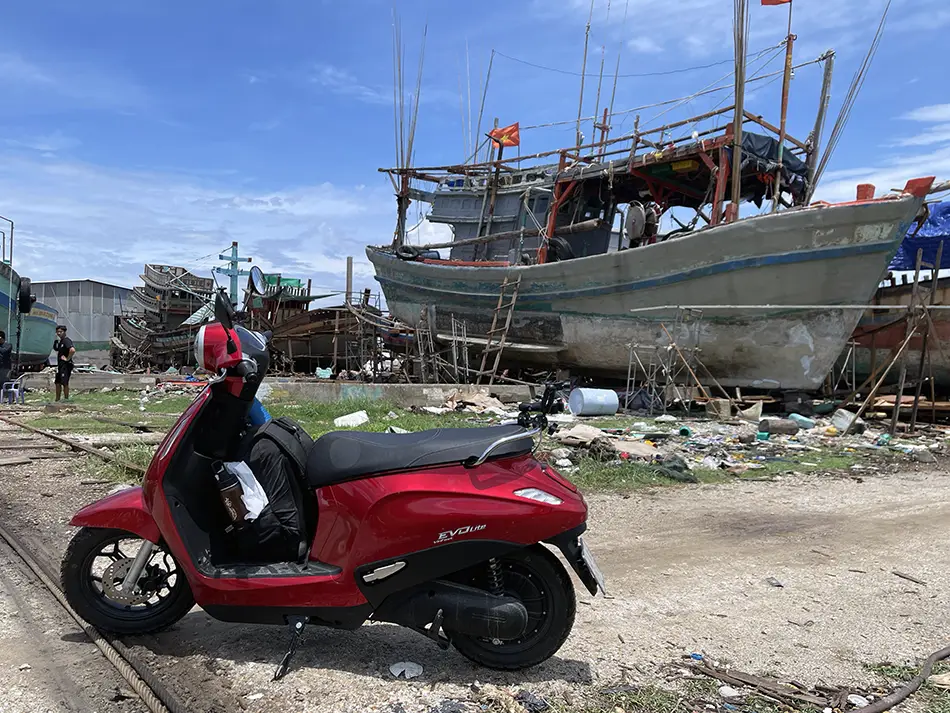
Next was Song Doc (Sông Đốc), a coastal town where one of the river’s arms meets the sea. After riding through small streets I came to an active boat repair yard. Strangers welcomed me onto the territory and walked me through what they were doing. Then north past banana plantations, through a rainstorm that cleared just in time to reach Hon Da Bac Islands (Hòn Đá Bạc) — two small islands you can walk to across a concrete causeway above the sea.
Closed the loop through U Minh Ha National Park (U Minh Hạ). Battery availability today was a different story compared to yesterday: stations were spaced well, and I never had to switch to eco mode.
Day 3: Ca Mau → Soc Trang — Khmer Temples and the Bac Lieu Wind Farm
May 30, 2026

| Start: Ca Mau | Finish: 📍Soc Trang |
|---|---|
| Distance | 229 km (142 mi) |
| Total distance | 545 km (339 mi) |
| Battery swaps | 5 |
| Spend | 495,000 ₫ (~$18.82) |
| Road quality | 4/5 |
| Scenery | 6/10 |
Scenery: Mangrove flats, offshore wind turbines standing in the sea, Khmer temples along the road.
Road Journal

Day 3 of crossing Vietnam south to north on an electric scooter. 229 km from 📍Ca Mau to 📍Soc Trang through 📍Bac Lieu.
First stop was 📍Tac Say Church, the pilgrimage site of Father Diệp. Sunday — the parking lot full, locals arriving for the service. Interesting buildings, statue out front. I didn’t go inside.
Heading for the well-known 📍Quan Am Phat Dai statue on the coast, I first ended up at 📍Bac Lieu Artificial Beach — a strange seaside amusement park with a Ferris wheel and a huge concrete head sculpted to look like carved rock. The Quan Am statue itself turned out smaller in person than in photos, but the garden was busy with Sunday crowds.

A small coastal road turned out to be the Khmer temple corridor — this land was once part of Khmer (Cambodian) Empire and the heritage remains. Temple after temple along the route, several with Sunday ceremonies. At 📍Wath Prek Chop the temple guards waved me in to watch — musicians, and a small parade. Foreign tourists are clearly rare here: local women immediately wanted photos.
Continued to the 📍Bac Lieu Wind Farm, Vietnam’s largest offshore wind farm. Concrete roads run straight into the sea with dozens of turbines in shallow water. I wanted to ride between them — the entrance was closed.
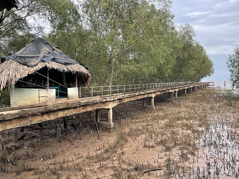
Late in the day I reached 📍Mo O beach , where a river arm meets the sea. A concrete pier on pillars stretches across mud and mangroves, almost empty. At the far end: mudflats alive with mudskippers. Locals were sliding across the mud on sleds with headlamps on, likely catching mudskippers (they’re eaten here).
Three days in, still no foreign tourists in sight.
Day 4: Soc Trang → My Tho — Mekong Delta Ferries and Island Routes
May 31, 2026
| Start: Soc Trang | Finish: 📍My Tho |
|---|---|
| Distance | 168 km (104 mi) |
| Total distance | 713 km (443 mi) |
| Battery swaps | 4 |
| Spend | 498,000 ₫ (~$18.94) |
| Road quality | 3/5 |
| Scenery | 6/10 |
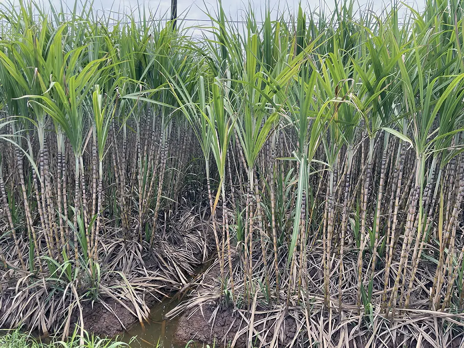
Scenery: River and shorelines from the ferries, banana plantations, sugarcane fields.
Day 4 of crossing Vietnam south to north on an electric scooter. 168 km from Soc Trang to My Tho with four battery swaps. The route went deep into the Mekong Delta on ferries and island roads — a deliberate dodge of the QL1A national highway.
The dilemma at the start: the two goals were pulling in opposite directions. The zero-emissions route ran on the highway — with trucks and buses. The route away from the highway crossed the Mekong arms on diesel ferries. I picked the ferries. The trip’s bigger purpose — showing the country can be ridden comfortably without a license and without the highway — won out over the smaller one.
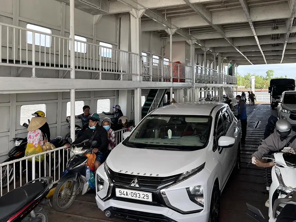
First ferry: 6,000 ₫, twelve minutes, mud-brown river, fishing boats.
Disembarked on 📍An Thanh, a Mekong Delta island with no Battery exchange stations at all. Rode it anyway. Small concrete paths cut through banana plantations and coconut groves. Houses modest but flowered. The local market had a wider seafood selection than the mainland — stingrays, octopuses, snails. A bridge is under construction nearby; the ferries here are on borrowed time.
Two crises followed in sequence. The SIM card died mid-day — and without it there was no way to find the next charging station or swap a battery. I caught Wi-Fi at a café, found the nearest carrier office, and rode over. It turned out Vietnam had introduced a new regulation tying SIMs to a national ID.
The staff had no clear procedure for a foreign passport and spent an hour trying to figure it out. They did everything they could. In the end, the only option was a new card.
Then the heat killed the battery: at 47°C the charge dropped from 7% to zero in seconds, leaving me 3 km short of the next station. I thought about pushing it, but that idea didn’t last long. I tried Grab — a driver accepted, drove past me, and left.
No other mototaxis available in the app. I stopped at a café for a coffee; the owner made a call, and a few minutes later someone drove me and my battery to the charging station and back for $2 (50,000 VND).

Reached My Tho through a downpour. The hostel owner — who I’d met on the way south — recommended Hu Tieu My Tho (Hủ Tiếu Mỹ Tho), the noodle soup the city is known for. First foreign travelers I’d seen in four days were at this hostel.
Day 5: My Tho → Vung Tau via the Coconut Monk’s Island
June 1, 2026
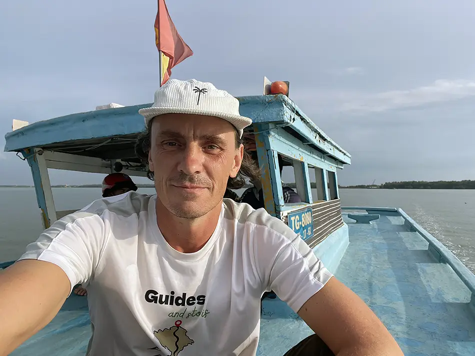
| Start: My Tho | Finish: 📍Vung Tau |
|---|---|
| Distance | 206 km (128 mi) |
| Total distance | 919 km (571 mi) |
| Battery swaps | 4 |
| Spend | 621,000 ₫ (~$23.61) |
| Road quality | 3/5 |
| Scenery | 5/10 |
Scenery: River and banks from the boat, banana plantations along the roads.
Day 5 of crossing Vietnam south to north on an electric scooter. 206 km from My Tho to Vung Tau, four battery swaps. The day went through two of the four famous Mekong Delta islands at My Tho, a controversial snake farm, a wooden boat ferry, the Can Gio mangrove biosphere, and ended on a ferry across the bay.
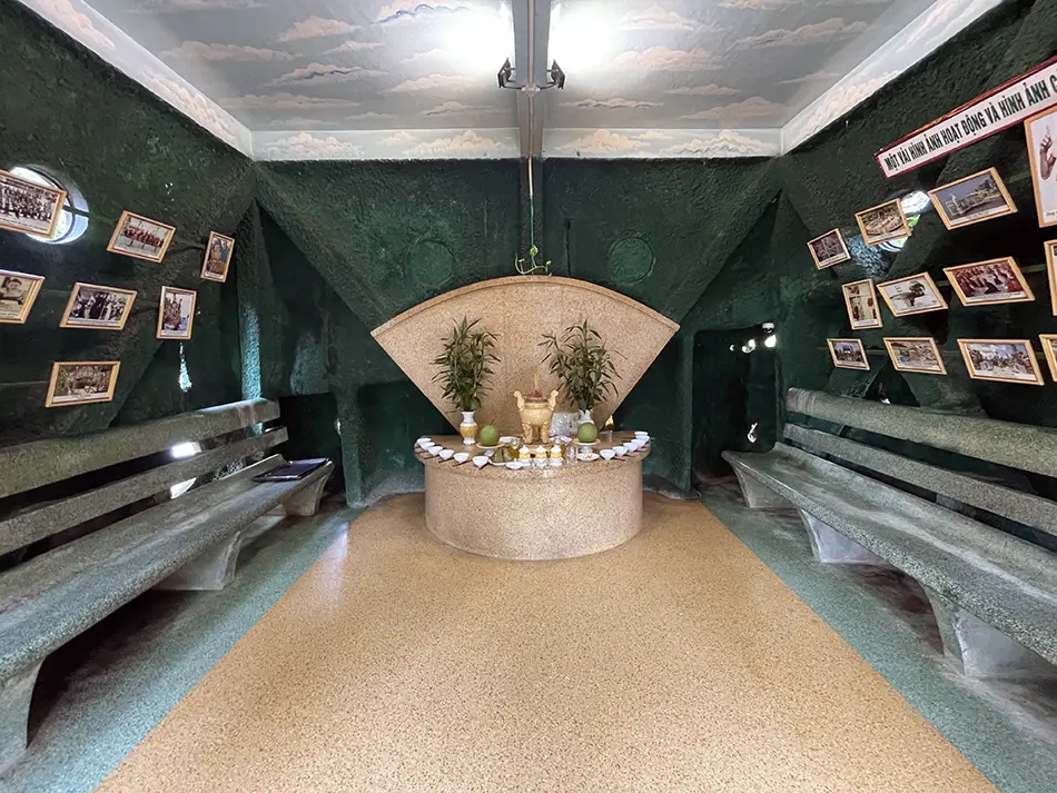
First thing in the morning I decided to explore the small islands around My Tho.📍Unicorn Island didn’t impress. The main road was under construction and the back lanes mostly led to coconut candy factories built for tourists. 📍Phoenix Island was a bit more interesting — this is where the Coconut Monk 📍lived, ate only coconuts, and founded a small religion. The site has been turned into a modest entertainment park with bamboo walkways, a pond with a bicycle path, and gazebos. From the monk himself only a small shrine, a closed tower, and a few relics remain.

The 📍Dong Tam Snake Farm, i visited after, turned out to be a mistake. It’s known as a military anti-venom facility, but it also functions as a low-quality zoo — deer, ostriches, a hornbill — all in small cages next to a noisy children’s carousel that frightens the animals. I regretted going.
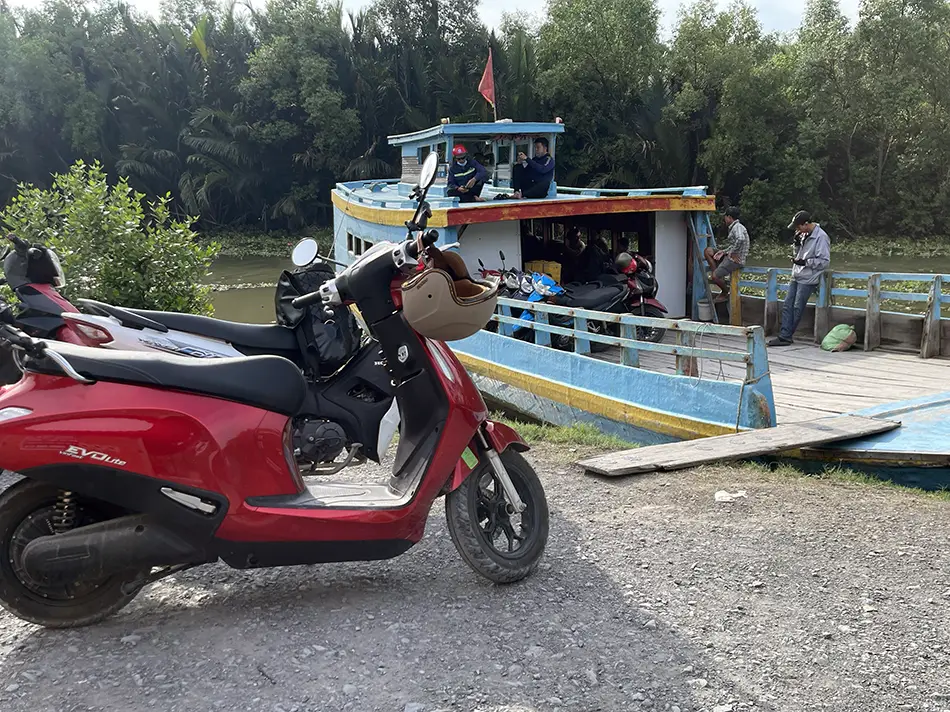
The bypass road east led to a ferry pier I wasn’t sure was operational — 📍Ben pha Gia Thuan. It turned out to be a large wooden boat in the middle of nowhere, locals delighted to see a foreigner. Fourteen motorcycles, about twenty-five people. The boat left, then turned around to come back for one late passenger.
Disembarked on 📍Can Gio, the mangrove biosphere reserve technically inside Ho Chi Minh City. Surprisingly good road, an electric public bus between towns.
Planned to stay overnight to see the bird sanctuary, but the coastal town turned out to be one continuous construction site — the entire shoreline is being walled off for a mega-development. All the “first-line” hotels face the wall. Lost the sanctuary plan, I took the 19:00 ferry to Vung Tau instead. Forty minutes across the bay.
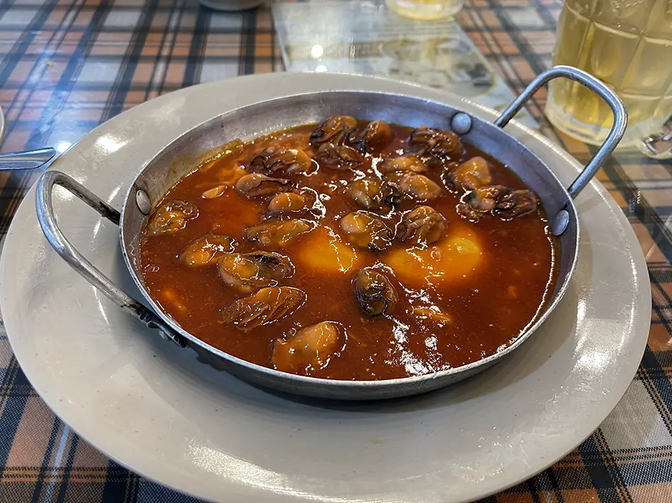
In 📚Vung Tau I went straight to my 📍known place for Hau Ne — oysters and shellfish on a sizzling cast-iron pan in sauce, the local seafood cousin of the more famous Bo Ne. Cheap hotel for 135,000 ₫. Vung Tau remains a great city.
Day 6: Vung Tau → Mui Ne — Empty Tunnels and a Flooded Phan Thiet
June 2, 2026
| Start: Vung Tau | Finish: 📍Mui Ne |
|---|---|
| Distance | 231 km (144 mi) |
| Total distance | 1,150 km (715 mi) |
| Battery swaps | 6 |
| Spend | 526,000 ₫ (~$20.00) |
| Road quality | 5/5 |
| Scenery | 6/10 |
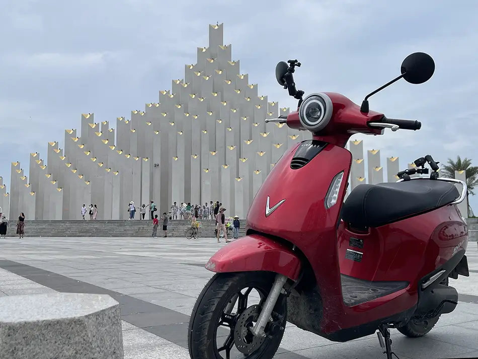
Scenery: A scenic ride along 📍Back Beach with public art installations; new developer projects with European-style facades — striking but empty. A long stretch of seaside road.
Day 6 of crossing Vietnam south to north on an electric scooter. 231 km from Vung Tau to Mui Ne, six battery swaps. Today’s ride included the abandoned Long Phuoc Tunnels, the Ke Ga Lighthouse on the coast, and an unexpected swim through a flooded Phan Thiet.
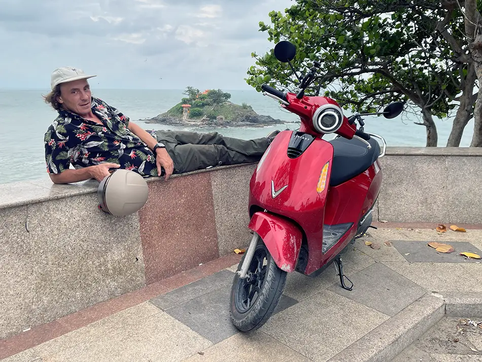
The morning was easy. Left Vung Tau in cloudy weather — bad for filming, good for riding. Honestly my favorite coastal city in Vietnam: wide streets, good air, calm. Dropped my 360 camera while shooting the scooter against Hon Ba, the small offshore island. Lenses scratched, but it still works.
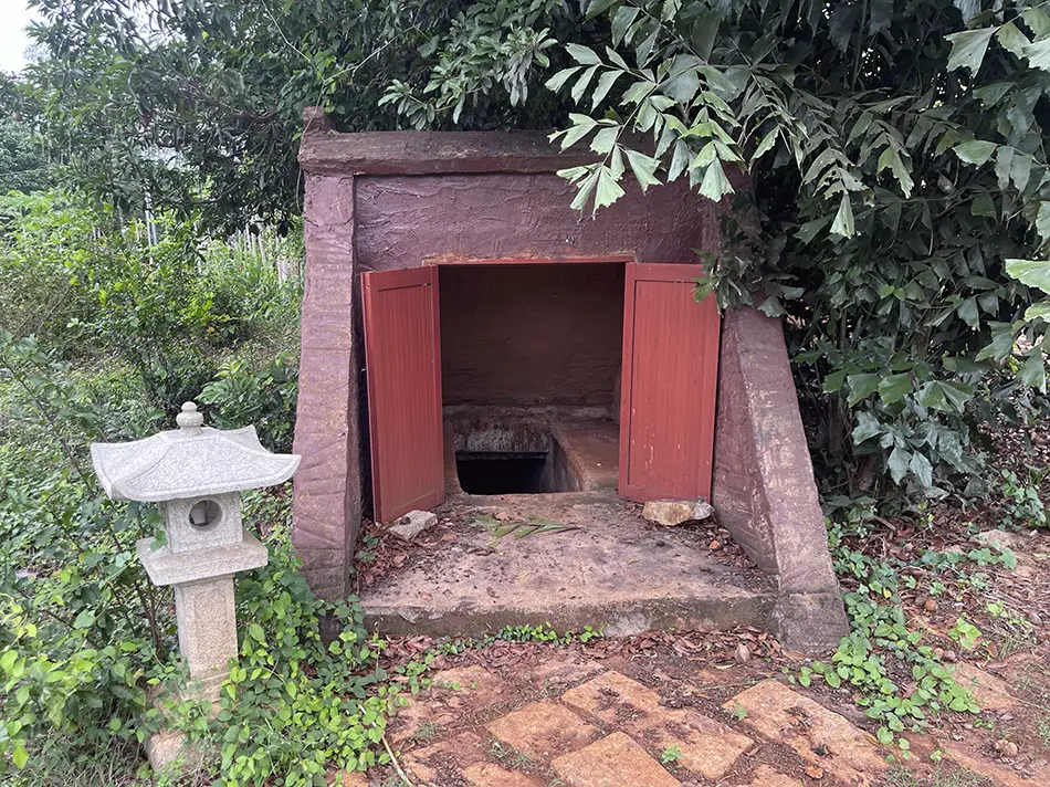
First stop was📍Long Phuoc Tunnels. No one around. Free entry. Couldn’t find the actual tunnel mouth at first — just administrative buildings. Once I did and started descending, the gate behind me creaked shut on its own. Ran out, caught my breath, went back in. The tunnels are large, at least two levels, with bats overhead and giant geckos on the walls.
Nobody knows you’re down there. This has nothing in common with Cu Chi, where tourists get bussed in by the dozen to crawl through a 50-meter section. For anyone who actually wants tunnels without the choreography, Long Phuoc is the answer.
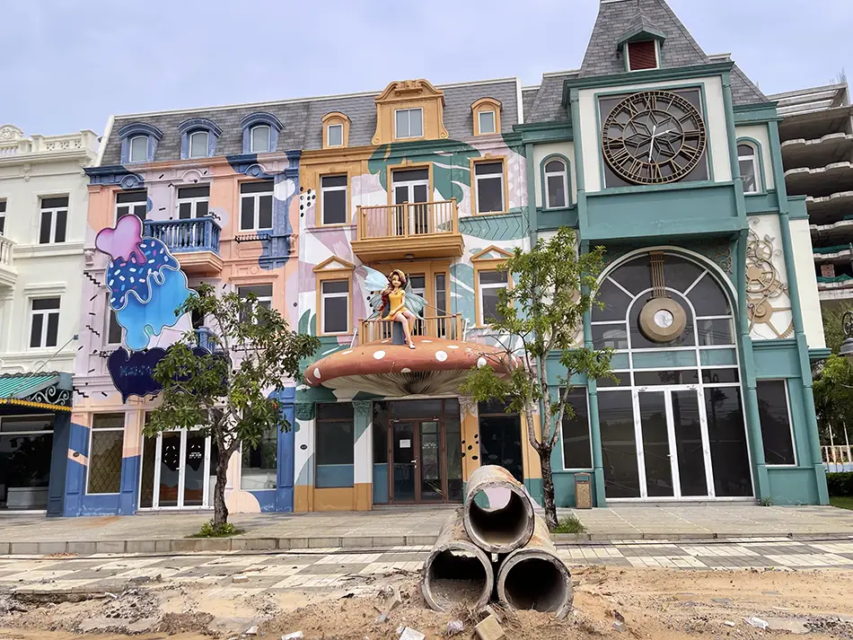
Almost a full battery of riding then went past coastal construction — five-star hotels, residential complexes, theme parks, everything Vietnam’s coast has been getting for a decade. All of it empty. European-style facades on streets nobody lives on.
Stopped at a beach campsite with the newer wave of amenities — air-conditioned tents, geodesic dome cabins, kayak and surf rentals.
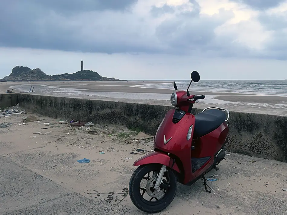
Made a little detour from the seaside road down to the beach promenade to see Ke Ga Lighthouse.

Approaching 📍Phan Thiet, the rain came in heavy. Twice I had to stop in roadside cafes to wait it out. Reached the city itself and found the streets under twenty centimeters of water — motorbikes literally floating. I crossed the scooter’s water-test the hard way. The scooter passed; “swam” is the better word.
I arrived in 📚Mui Ne soaked through, and decided to celebrate survival with a pizza at 📍Dong Vui Food Court. (Very decent)
Day 7: Mui Ne → Lien Huong — Sand Dunes and Riding Through Rain
June 4, 2026
| Start: Mui Ne | Finish: Lien Huong |
|---|---|
| Distance | 87 km (54 mi) |
| Total distance | 1,237 km (769 mi) |
| Battery swaps | 2 |
| Spend | 383,000 ₫ (~$14.56) |
| Road quality | 5/5 |
| Scenery | 6/10 |
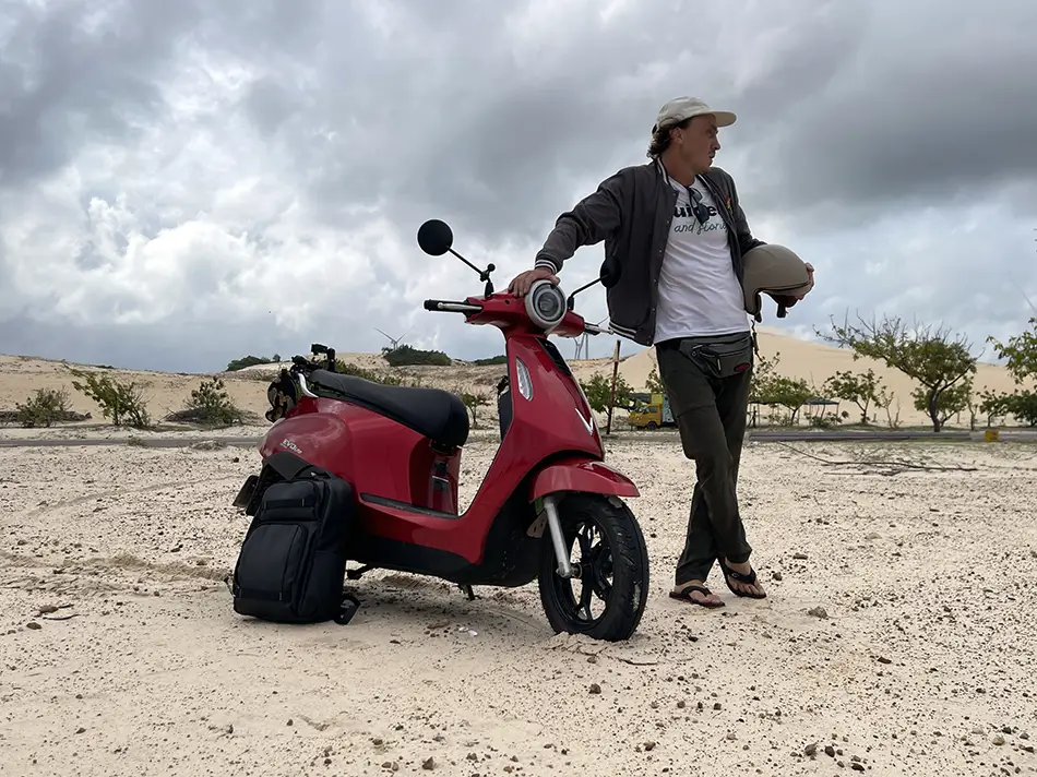
Scenery: The Red Dunes, the freshwater Bau Trang lake and the neighbouring White Dunes, quiet coastal bays, Cu Lao Cau seen from the shore, unusual pine forests running right along the sea, and small fishing towns with everyday life on display.
A half day, mostly by force of the weather. It rained through the morning in Mui Ne, and the coastal road ahead deserves at least a bit of sun to be worth riding. Waited until noon, gave up on the sun, and rode out anyway.
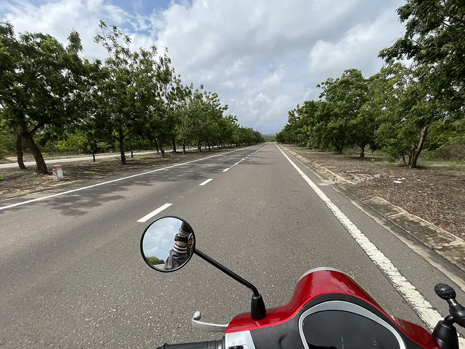
The route passed through the 📍Red Dunes, then the 📍White Dunes and the freshwater 📍Bau Trang lake, on along the coast with the 📍Turtle Island visible offshore. It was raining the whole way, and i had to stop in a small café inside a coastal pine forest for a bowl of noodles when it got heavier. Then the road took me through 📍Phan Ri.
Pulled into Lien Huong earlier than planned rather than push on toward Phan Rang. There is a serpentine stretch coming up that is too good to spend on a grey rainy day.
Better to wait one out here and take it in the sun tomorrow. Stayed at 📍Khach san Dai Nam hotel. Good location and price.
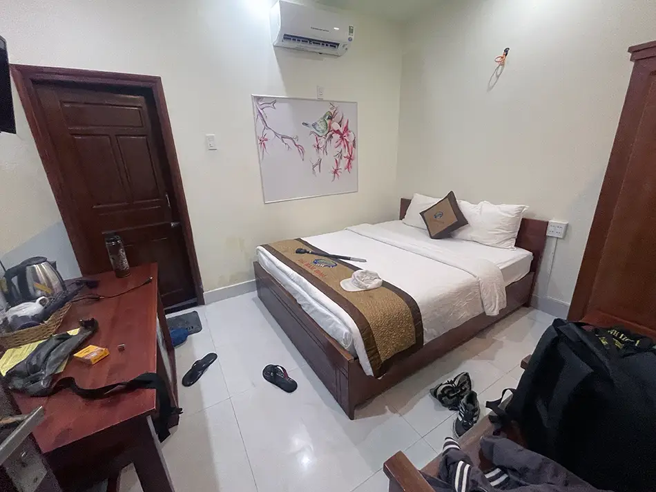
Battery swap availability was good today — no need for eco mode. Two swaps for the day. $14,6 total spent including a budget hotel room. Sometimes the trip decides to slow you down, and you take it.
Day 8: Lien Huong → Phan Rang — Empty Coast Road and Salt Farms
June 5, 2026
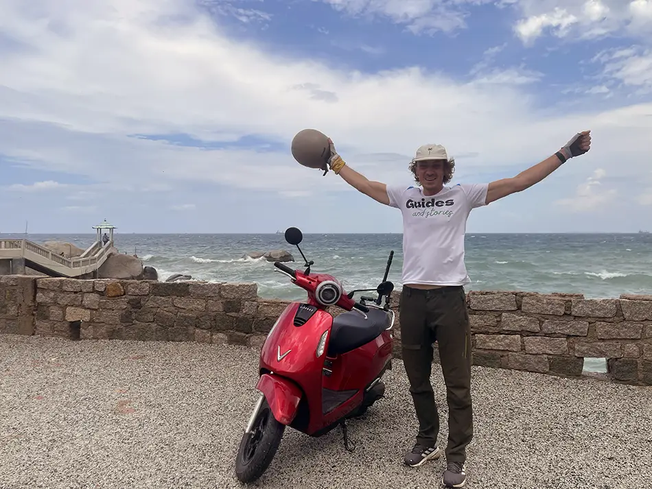
| Start: Lien Huong | Finish: Phan Rang |
|---|---|
| Distance | 97 km (60 mi) |
| Total distance | 1,334 km (829 mi) |
| Battery swaps | 2 |
| Spend | 483,000 ₫ (~$18.37) |
| Road quality | 5/5 |
| Scenery | 8/10 |
Scenery: A quiet coastal serpentine running directly between the sea and the mountains, viewpoints over blue bays from height, salt farms, sand dunes and the lighthouse, and small fishing towns along the way.
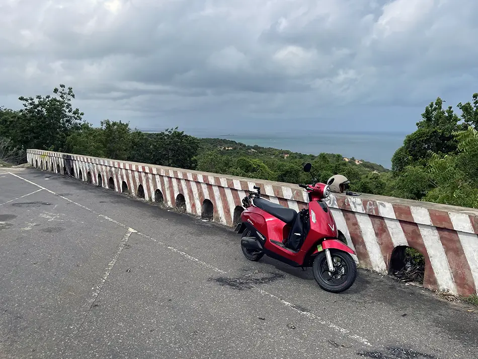
The serpentine that had made me stop short yesterday delivered. This was the most scenic stretch of the whole trip so far.
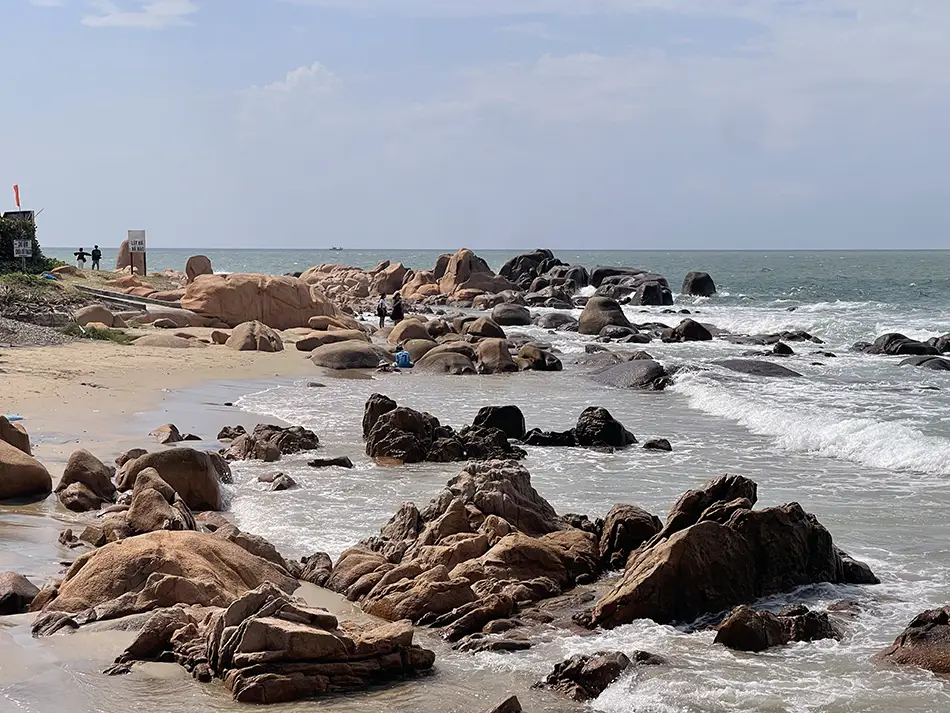
The road ran along the coast, at one point right next to the water, with low mountains on the opposite side. My first stop was the famous mossy beach at 📍Co Thach, where I parked, drank a coffee overlooking the tide, and got back on the road. The rocks were bare rather than green — it wasn’t moss season, so the vivid version you see in social-media photos wasn’t showing up.
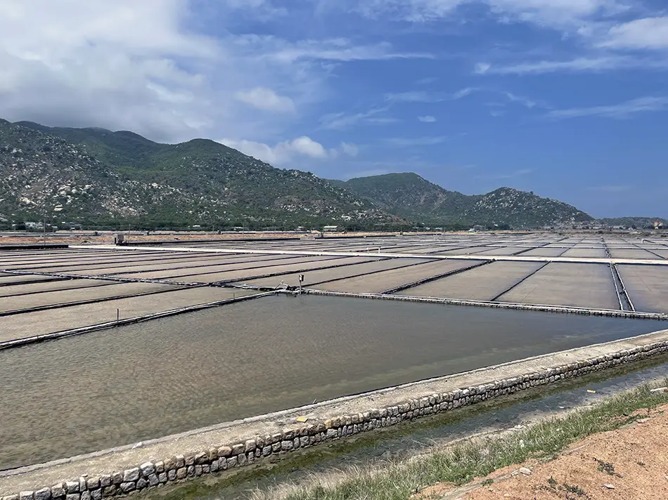
Just past 📍Ca Na, the landscape flattened into salt farms, the pans where seawater is left to evaporate in the sun. Then the road climbed a switchback into the mountains, gaining altitude with bigger and bigger views over the sea.
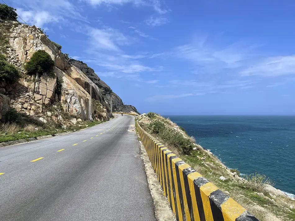
The scooter handled the climbs without needing eco mode. Closer to Phan Rang, the road turns inland and crosses a sand dune with the sand actually blowing across the tarmac, before opening up to sweeping views of the 📍Mui Dinh Lighthouse.
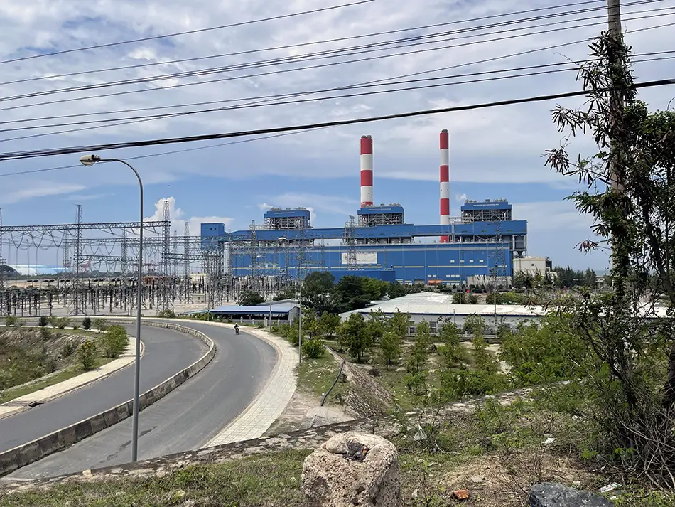
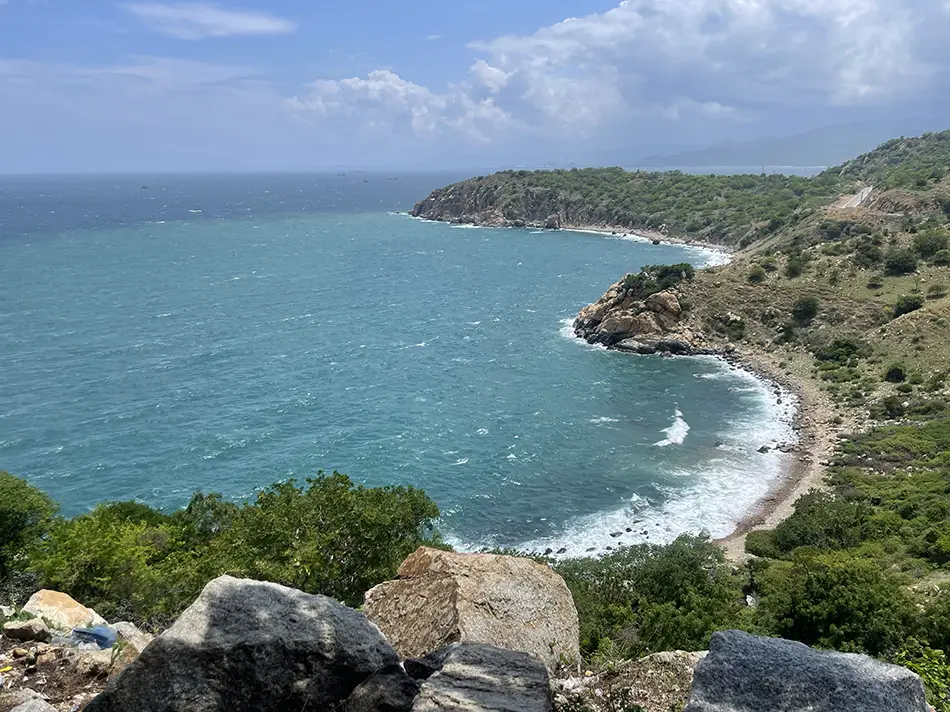
What makes this stretch what it is: it’s almost empty. The QL1A national highway runs parallel a bit inland, and anyone with somewhere to actually be uses that. Only tourists take the coast road. The result is a first-rate ride with almost no one on it.
I made 97 km on the day, though it felt like less, because I kept stopping to photograph and film. Two battery swaps, ~$18 spent (483,000 ₫), including the mossy-beach coffee and dinner in Phan Rang.
Day 9: Phan Rang → Cam Ranh — Vineyards and Cliff Coast Serpentines
June 6, 2026
| Start: Phan Rang | Finish: 📍Cam Ranh |
|---|---|
| Distance | 155 km (96 mi) |
| Total distance | 1,489 km (925 mi) |
| Battery swaps | 4 |
| Spend | 411,000 ₫ (~$15.63) |
| Road quality | 5/5 |
| Scenery | 9/10 |
Scenery: The wide open streets of Phan Rang, a temple on boulders, coastal mountains and switchbacks running high above blue bays, vineyards and plantations of aloe vera and garlic, and the near-perfect Vinh Hy Bay.
The scenery got a new record today. Nine out of ten.
I started with a walk around Phan Rang before heading out. It’s a beautiful city with wide streets, mountains visible from the middle of town, a good beach, and the 📍Chua Trung Son Co Tu temple sitting on a boulder outcrop. Salt farms sit just outside the city.
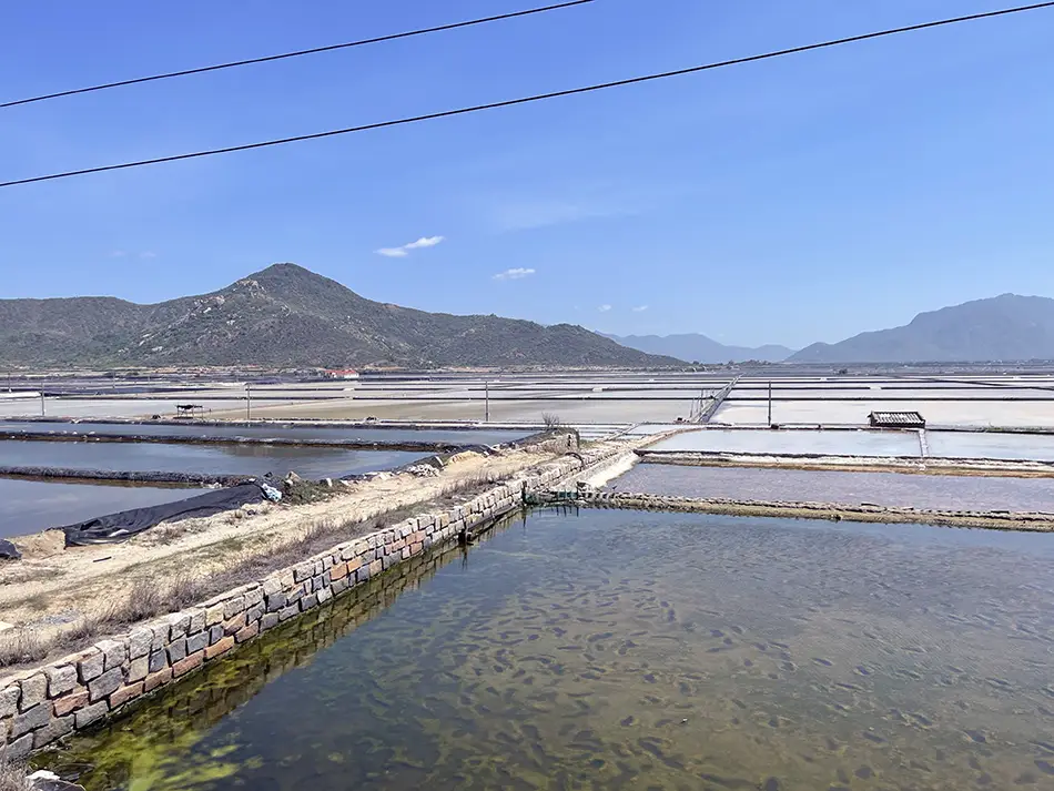
Once out of town, the landscape becomes something else. Cliffs on one side, sea on the other, blue bays with kite-surfers.
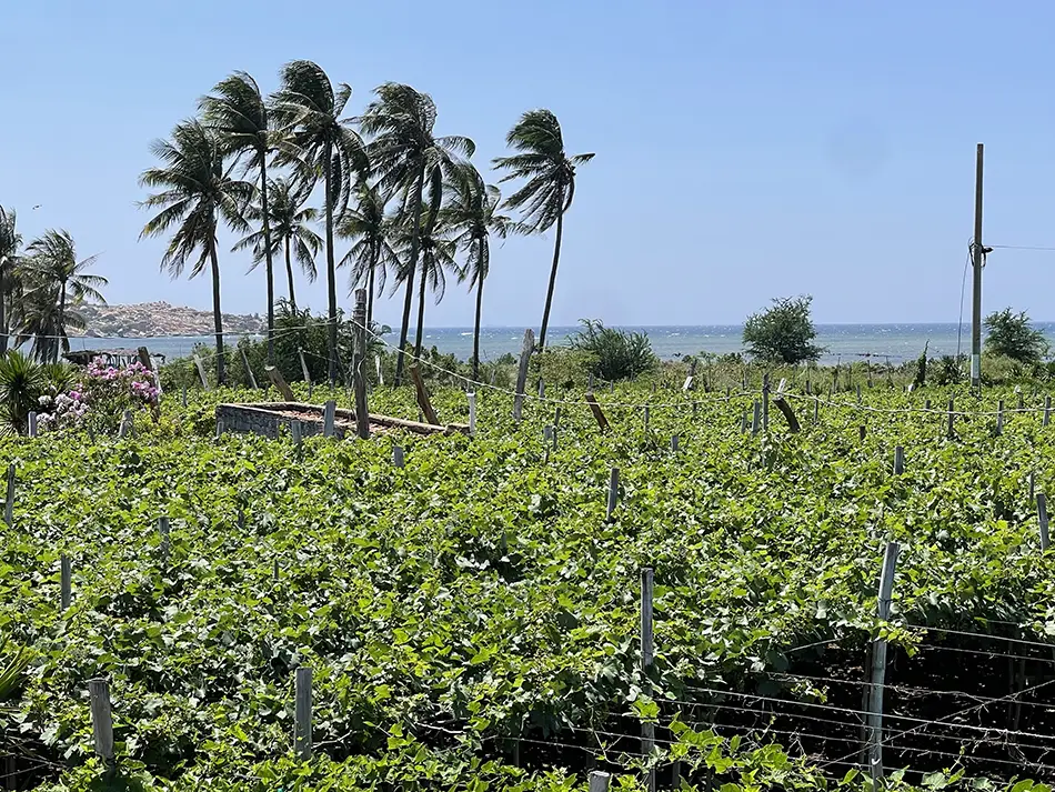
The road passes through vineyards and aloe vera fields. This whole Phan Rang / Ninh Thuan valley is one of Vietnam’s most under-visited regions for foreign travelers, and it’s easy to see why more people don’t come.
There’s no single “landmark” to pull a tour bus in. It’s slow, vibe-first travel: you ride, you look, you eat something local. The potential of the region is quiet and enormous.
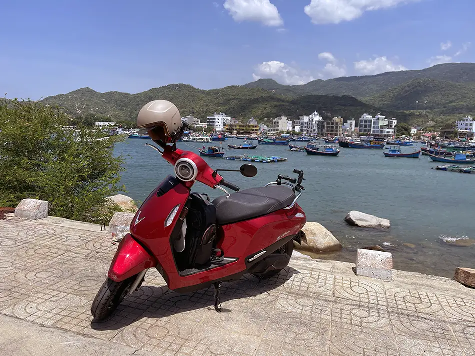
Past the valley the road climbs and drops into 📍Vinh Hy Bay, where the views are great and there are apparently coral reefs offshore. It was a weekend, though, so domestic tourists were out and I didn’t linger.
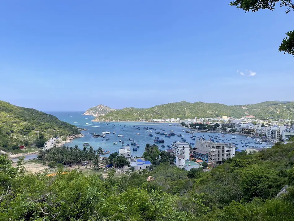
After Vinh Hy Bay, the coastal road climbs up, offering some of the best viewpoints in Vietnam. It twists up and down, giving you views of turquoise water bays, a big island close to the shore, abandoned luxury villas, and a golf course. That’s where the scenery gets a solid 9 out of 10.
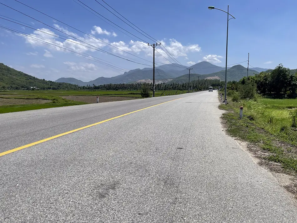
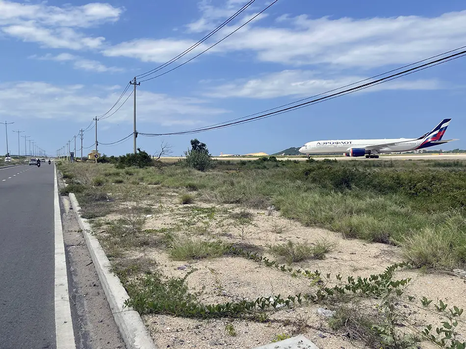
The last third of the day was highway, unavoidable, and I dropped off it at 📍Cam Ranh airport to ride along the resort coastline into town. The airport-strip drivers, especially the taxis and buses, are noticeably worse behaved than anywhere else on the route so far. Ended the evening on the Cam Ranh beaches.
Stayed at 📍An Binh Homestay: extremely basic, but since I had no plan to stay in the room when the beach was so close, I didn’t mind. Especially considering the price of $7.50 (200,000 ₫).
I made 155 km (96 mi) on the day. Four swaps, ~$16 spent (411,000 ₫).
Day 10: Cam Ranh → Da Lat — The 49-km Climb and Mountain Air
June 7, 2026
| Start: Cam Ranh | Finish: 📍Da Lat |
|---|---|
| Distance | 165 km (103 mi) |
| Total distance | 1,654 km (1,028 mi) |
| Battery swaps | 5 |
| Spend | 455,000 ₫ (~$17.30) |
| Road quality | 3/5 |
| Scenery | 7/10 |
Scenery: Serpentines climbing out of the coast, green valleys with cows and river buffalos on the pastures, pine forests, and mountain switchbacks with towns visible in the valleys below.
The most technically critical stretch of the trip so far was today.
I left Cam Ranh riding along the resort strip in the reverse direction first, and then pulled out onto the coastal highway. Loud, packed, uncomfortable, the way that highway always is.
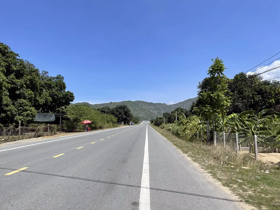
The moment I turned off onto 📍QL27B up toward Da Lat, all that disappeared. Mountains rose around me. The road was almost empty, apart from a few wandering river buffalos, and it went up and down through green valleys.
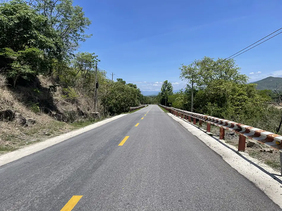
What did not disappear, though, was a real anxiety about what was coming. On the mountain road up to Da Lat, there is a single working swap station in a 49 km stretch, and that stretch is all climb. Fifty km fits inside the scooter’s range on paper. Doing fifty km uphill on a single battery is a different problem.
I stretched all 49 km in eco mode and made it to the swap station with about 20 percent left. Then immediately overheated in the noon sun myself and felt slightly unwell. Found a café with hammocks by the road, drank a coconut, and lay in the shade for almost an hour. Riding at 31 km/h in noon heat is a worse idea than it sounds. At higher speed the wind at least cools you. At eco-mode speed you’re just lying on a hot pan.
Feeling better, kept going. The road climbed on switchbacks for most of the rest of the way, and this time the scooter overheated instead of me — it started losing power on the climbs. I stopped in the shade for 20 minutes and it recovered.
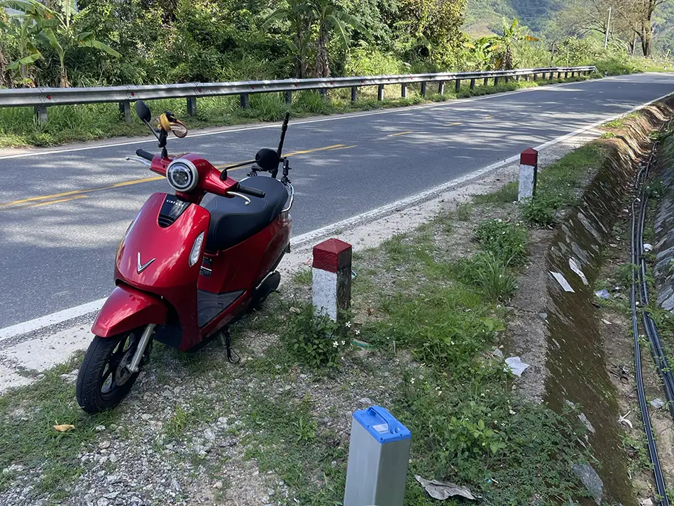
The higher I got toward 📚Da Lat, the better the air became. Cool, pine trees, a different regime of existence. In Da Lat itself the swap network is fine, and I rode straight to the hotel. Decided the next day would be a rest day. Enough of the heat for now.
I made 165 km on the day. Five swaps, ~$17 spent (455,000 ₫).
Day 11: Da Lat → Buon Ma Thuot — Passion Fruit and Coffee Country
June 9, 2026
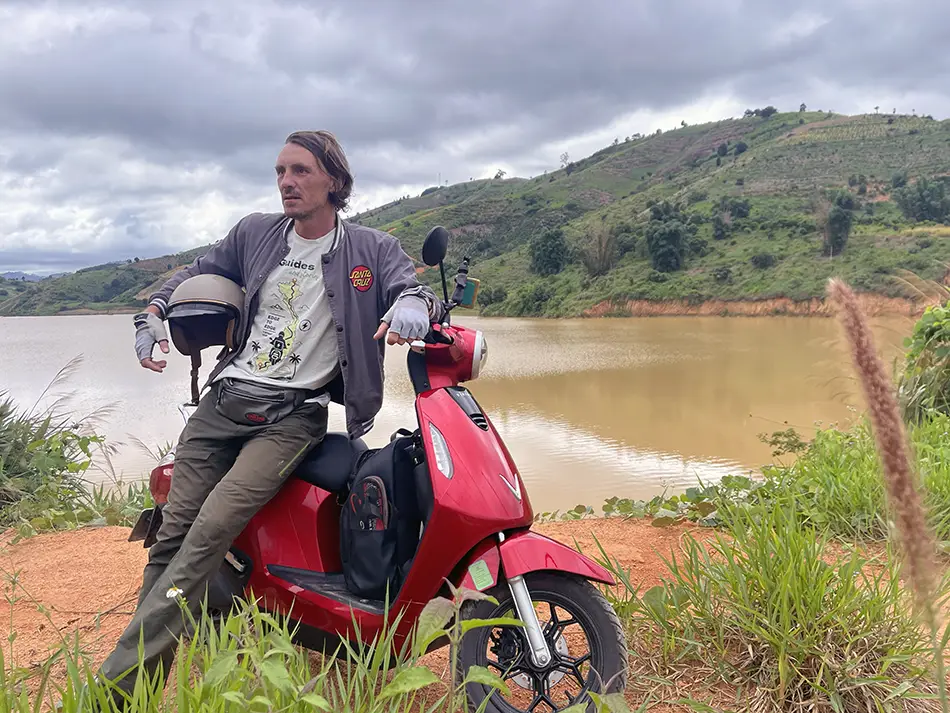
| Start: Da Lat | Finish: 📍Buon Ma Thuot |
|---|---|
| Distance | 210 km (130 mi) |
| Total distance | 1,864 km (1,158 mi) |
| Battery swaps | 6 |
| Spend | 559,000 ₫ (~$21.26) |
| Road quality | 4/5 (2/5 on the back roads) |
| Scenery | 6/10 |
Scenery: Pine serpentines, cassava plantations and passion-fruit orchards on the back roads, mountains, and coffee plantations on the approach to Buon Ma Thuot.
Rested a day in Da Lat on June 8 before setting off toward Buon Ma Thuot. Cool morning, overcast, the exact opposite of the previous ride into Da Lat in noon sun.
The first eight kilometres out of the city ran on a beautiful serpentine down through pine forests. I passed a small town in about ten minutes and stopped at the edge for a bánh mì with fried egg and coffee before turning off the main road onto a bypass. Narrow concrete that eventually gave up and turned into gravel.
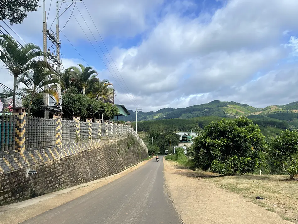
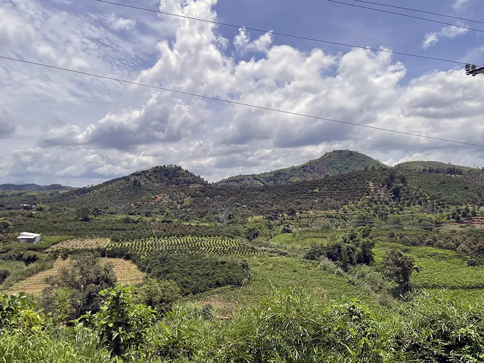
The views made up for the surface. Cassava plantations and passion-fruit orchards on both sides, mountains behind. This is the part of the trip I had been earning — small back roads across the interior, not the QL27 alone. Rode slowly to the next small town, swapped a battery, and rejoined the main road.
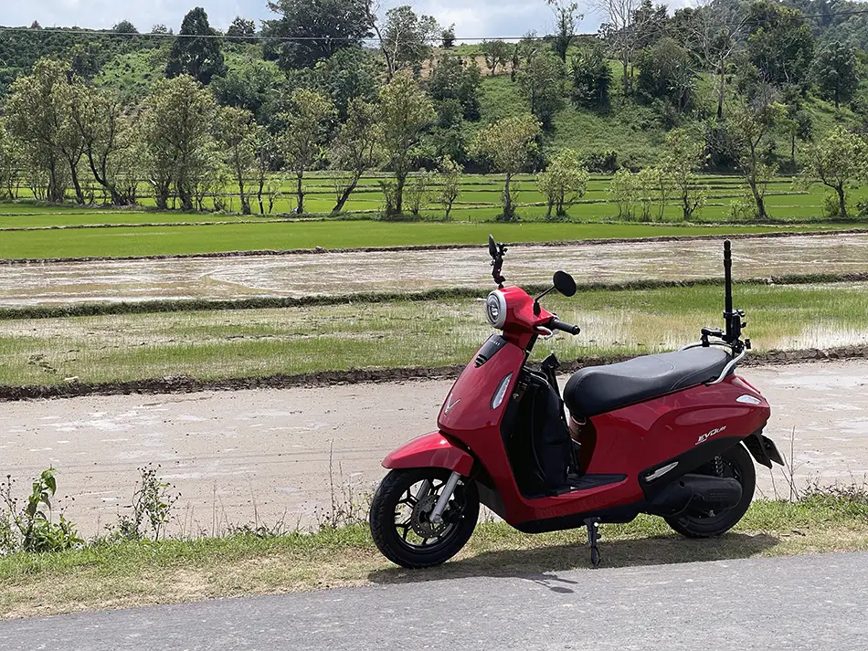
What followed was a fairytale stretch: an almost empty serpentine, views of fields and hills, cloud cover keeping the temperature low, forest on both sides. It made me forget the heat of the previous day entirely.
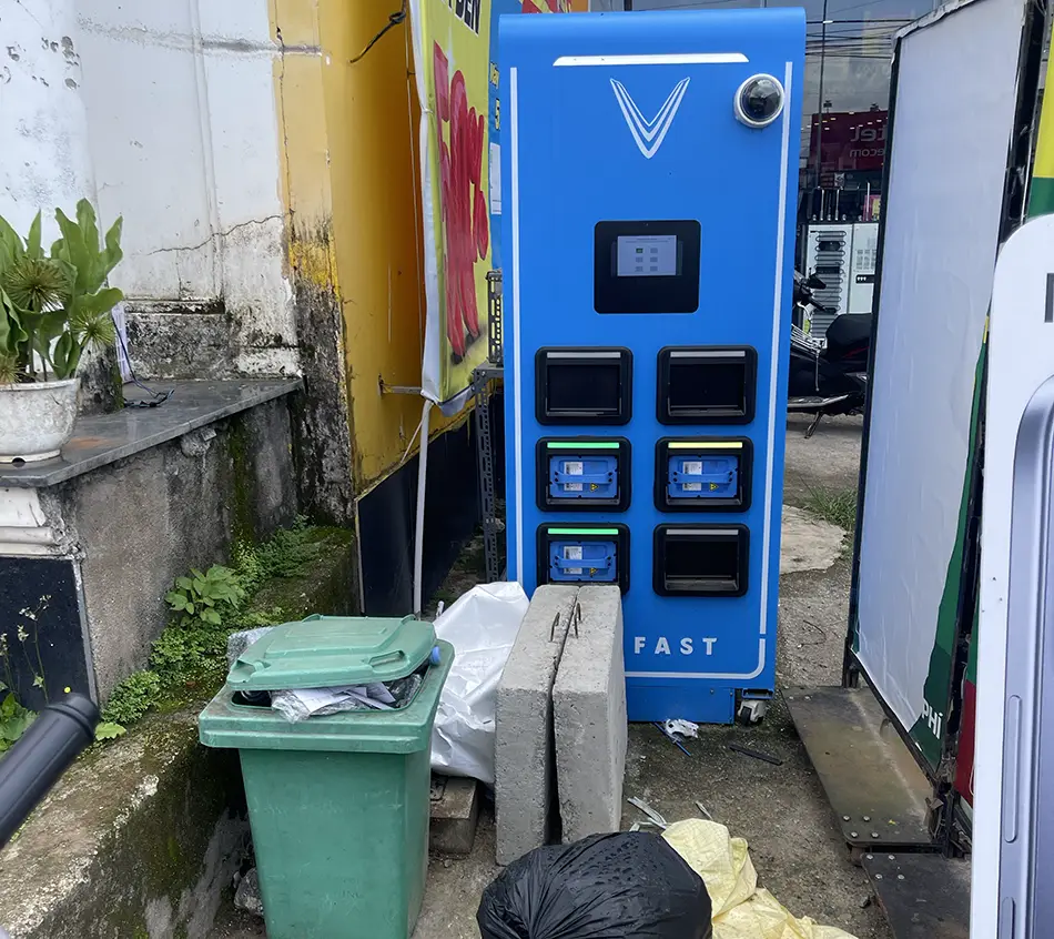
At the next swap station, the cabinet was buried under piles of junk and locked behind the building’s main electrical panel. I had to fight my way in with the batteries. Real state of the network.
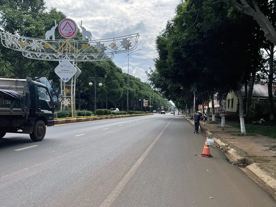
The final stretch was on QL27. Road quality around four out of five. Coffee plantations replaced the passion-fruit as I got closer to Buôn Ma Thuột — the city is the capital of Dak Lak province and the heart of Vietnam’s coffee industry.
The last 20 km before entering the city, however, were on a proper highway with trucks, buses, horns, chaos.
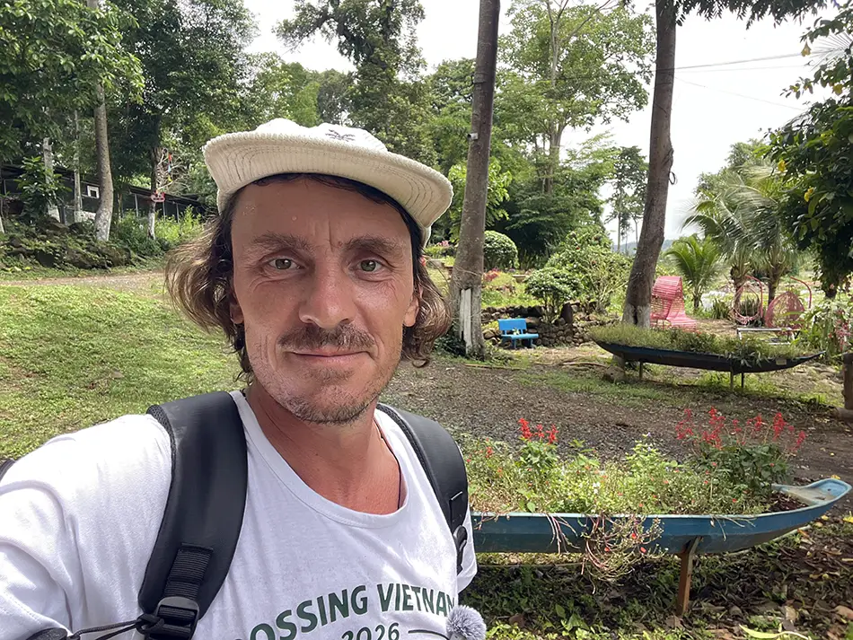
In Buon Ma Thuot I went for dinner at a place I thought would serve authentic ethnic-minority cuisine (📍Arul House). It turned out to be a pretentious restaurant with high prices, but the food is genuine: kitchens of the local E De, M’nong, and Jarai peoples. Whether it was worth it is subjective, but those two dishes actually cost more than my place to stay. No joke.
I made 210 km on the day. Six swaps, ~$21 spent (559,000 ₫).
Day 12: Buon Ma Thuot Loop — Lava Tunnels and an Ethnic Longhouse
June 10, 2026
| Start: Buon Ma Thuot | Finish: Buon Ma Thuot |
|---|---|
| Distance | 143 km (89 mi) |
| Total distance | 2,007 km (1,247 mi) |
| Battery swaps | 4 |
| Spend | 488,000 ₫ (~$18.55) |
| Road quality | 3/5 |
| Scenery | 6/10 |
Scenery: A wide jungle waterfall, an ancient underground lava tunnel lit by torchlight, a clear freshwater lagoon with wooden logs at the bottom, and a traditional stilted house of the local highland peoples.
The day was a loop out of Buon Ma Thuot to explore what’s around the city. The painful logistical constraint of the region: all battery swap stations sit strictly on the main highway, so every point of interest off the highway cost extra range to reach and return from.
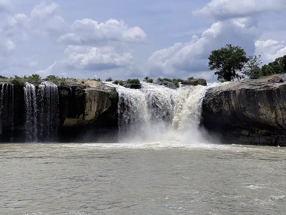
First stop was the 📍Dray Sap waterfall, 25 km up a loud, bus-heavy highway. There’s an entertainment park around it, with a wobbling suspension bridge over the lake. Halfway across, a group of local women started rocking it harder on purpose to try to make me fall.
Good fun. Sadly, the site also has a zoo attached, and the animals looked in very poor shape.
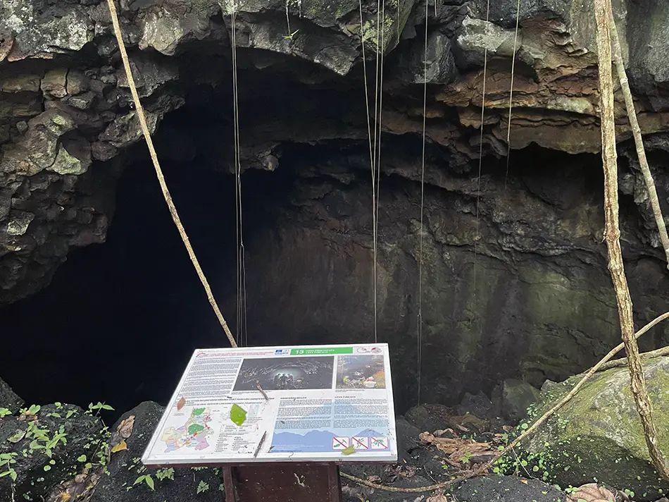
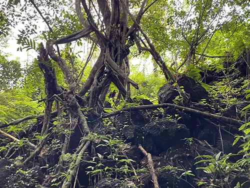
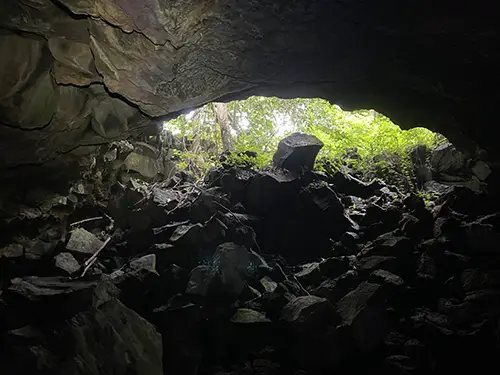
Next was the 📍Cua Hang Dong C8 lava caves, part of the UNESCO Dak Nong Global Geopark.
On the dirt track to the trailhead, a Vietnamese woman flagged me down and offered to ride along, convinced through a translation app that I was heading the wrong way. It was a little bit of an awkward moment, as she thought I was going to the volcano and wanted to join me, but I kept explaining that I was going to the caves. We drove together anyway, then walked into the jungle toward the cave.
About fifteen minutes in, her mother “called” and asked her home for dinner, so she had to leave. I didn’t need company for that adventure anyway.
The cave was another 50 metres past where she’d turned around. Two entrances into two branches of the same tunnel. Walked in with a flashlight, always carry one — the tunnel runs about 1,200 meters underground. I didn’t go that deep, but it was fun.
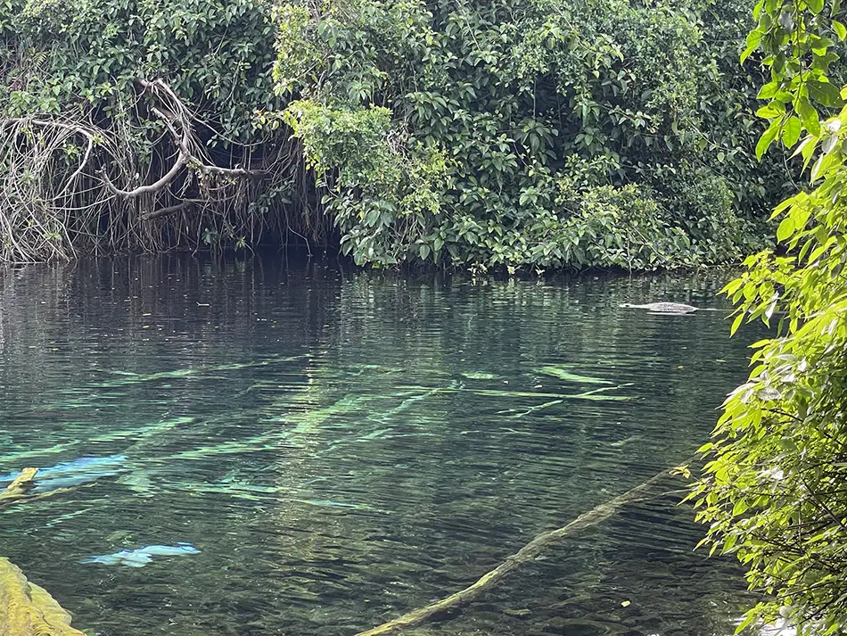
Last stop was a 📍Ho Da freshwater lagoon that had looked beautiful in photos. In practice, a lot of trash, clear water full of submerged logs, and some teenagers on a rope swing. Saw it and moved on.
Slept the night in a traditional highland longhouse (📍Berry Homestay) that had been moved here and set up as a homestay. Ground floor is just support posts and a covered sitting area with a teapot. Upper floor is one long open room divided by hanging fabric instead of walls, mattress on the floor, mosquito net around the bed. The host was running serious separated-waste composting on the property.
I made 143 km on the loop. Four swaps, ~$19 spent (488,000 ₫).
Day 13: Buon Ma Thuot → Pleiku — Coffee Slopes and Stinky Crab Soup
June 11, 2026

| Start: Buon Ma Thuot | Finish: 📍Pleiku |
|---|---|
| Distance | 212 km (132 mi) |
| Total distance | 2,219 km (1,379 mi) |
| Battery swaps | 5 |
| Spend | 398,000 ₫ (~$15.13) |
| Road quality | 3/5 |
| Scenery | 5/10 |
Scenery: Rubber plantations, coffee slopes, pines along the road, wind turbines on the ridges, distant mountains, and a small city built around a lake at its centre.
Expected a nightmare highway day. Got something quite different.
I left Buon Ma Thuot at the start of what should have been the worst kind of highway riding: this region’s roads are usually packed with speeding trucks and buses.
Twenty kilometers in, I gave up and turned off onto a small back road just to escape them, taking a completely irrational detour of about 20 extra kilometers.
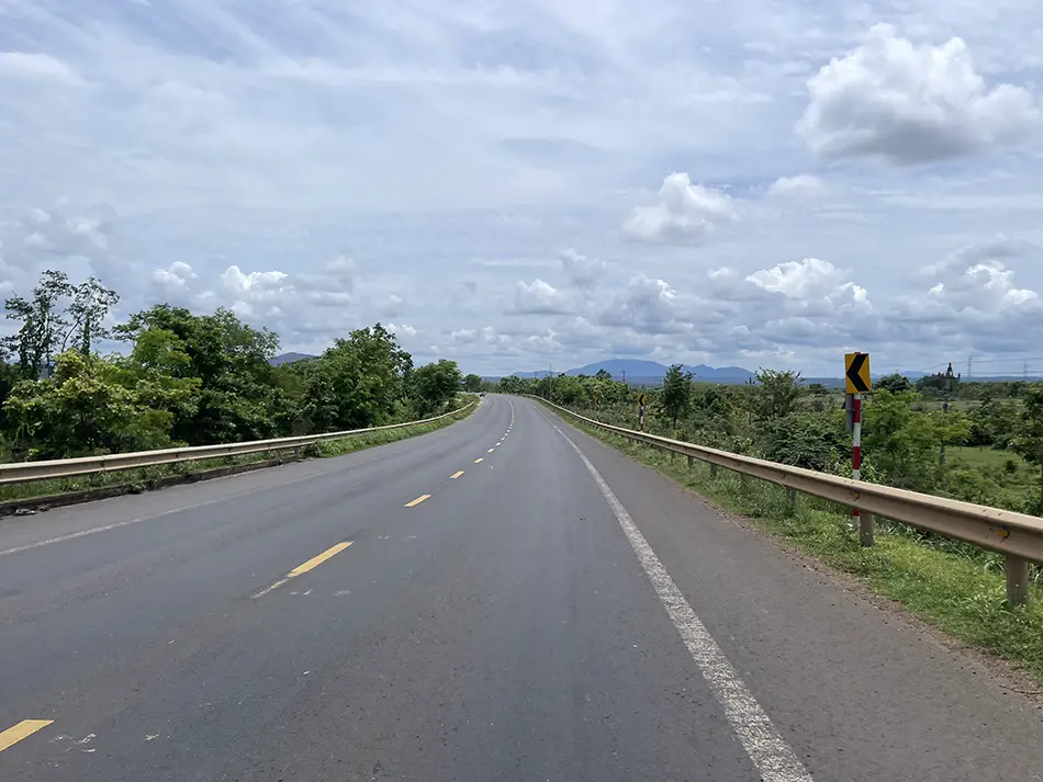
The road quality immediately dropped to 2/5, but the trade was worth it: rubber plantations, coffee slopes, and quiet village life. Rode until the battery forced me back onto the main road.
To my surprise, this part of the highway wasn’t the disaster I’d expected.
The trucks were still there and still honking like something was wrong, but pines grew on both sides, hills with coffee plantations stretched into the distance, and wind turbines turned slowly on the ridges.
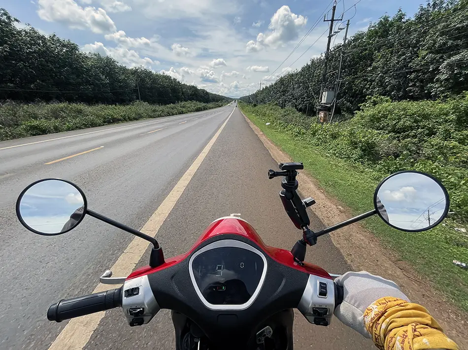
The road runs along elevation, so the temperature stayed comfortable. Tolerable — nowhere near what I had braced for.
The rest of the ride went the same way: hills left and right, up and down, coffee everywhere, a breeze from the elevation. Genuinely fine.
Pleiku itself turned out to be a beautiful surprise. Cheap hotel with a view over📍Ho Duc An lake, calm city.
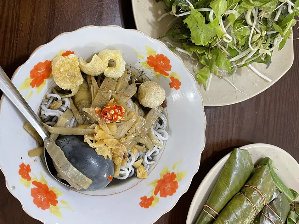
For dinner I tried the local speciality: Bun cua thoi, literally “stinky crab noodle soup”. Fermented crab is the base of the broth and the smell does what it says on the tin. Push past that and the taste is interesting and specifically local — the signature dish of Pleiku and the wider Gia Lai province.
I made 212 km on the day. Five swaps, ~$15 spent (398,000 ₫).
Day 14: Pleiku → Kham Duc — Jungle Cliffs and a 56-km Battery Gap
June 12, 2026
| Start: Pleiku | Finish: 📍Kham Duc |
|---|---|
| Distance | 280 km (174 mi) |
| Total distance | 2,499 km (1,553 mi) |
| Battery swaps | 7 |
| Spend | 658,000 ₫ (~$25.02) |
| Road quality | 2/5 |
| Scenery | 9/10 |
Scenery: Rubber plantations at industrial scale, green mountains and coffee hills, an eerily empty border road with dust drifting across it, and towering jungle cliffs draped in lianas along a two-lane road that follows a river.
Crazy day. First the aesthetic of empty roads, then a battle through the rain on a wild mountain serpentine.
Left Pleiku around 8:20, and drove through Kon Tum. A genuinely handsome city with topiary sculpted between the road lanes. Cool morning, rolling road, coffee plantations on both sides.
On the way to 📍Dak To I stopped for what turned out to be the most expensive rice of the entire trip: chicken thigh with two fried eggs for 80,000 ₫.
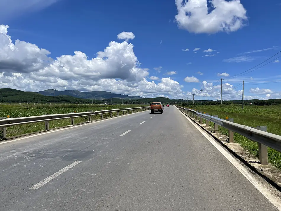
Detoured onto a dirt track through massive rubber plantations, thousands of trees bleeding sap for the global shoe-sole industry.
Reached 📍Bo Y, a small border town with a surprisingly well-kept main street and bushes cut into the shapes of dragons. From there I looped up to the Lao border renew my Vietnamese visa.
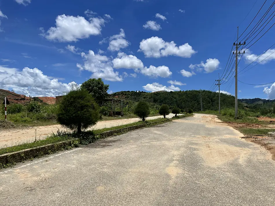
NOTE: the list of passports eligible for visa-on-arrival (Laos side) on this specific crossing is very short.
Two roads lead there. The lower one is a truck highway; the upper one is dusty, almost empty, unnaturally wide, and post-apocalyptic in feel. The border loop ate a whole battery.
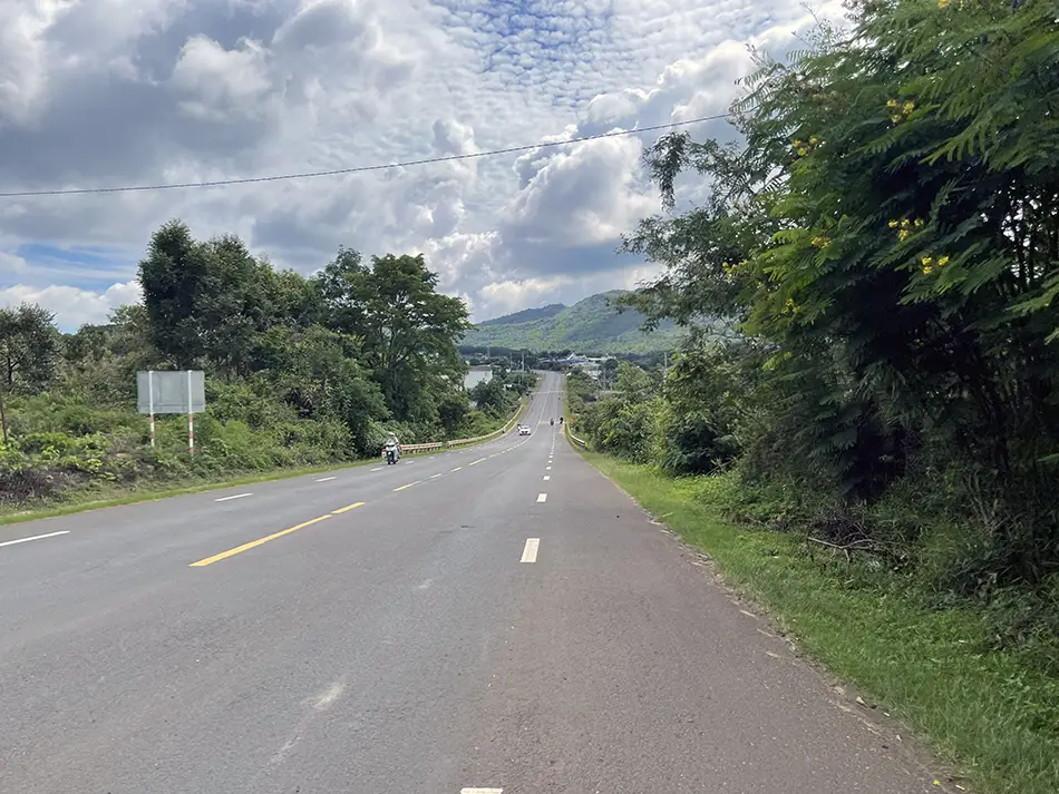
From Bo Y toward 📍Dak Pek, the trucks disappeared entirely. Two lanes, huge mountain views, then a long stretch along a river with locals fishing and kids playing with nets.
Then came the hard part: Dak Pek to 📍Kham Duc, 56 km without a single working swap station between them. The biggest gap of the trip so far.
Climbed the mountains in eco mode and coasted the downhills almost without touching the brakes. The reward: cliffs draped in lianas, tree trunks so wrapped in creeper vines they looked like green columns rather than trees. Nowhere else on the trip like it.
Rating jumped to 9/10 on the spot.
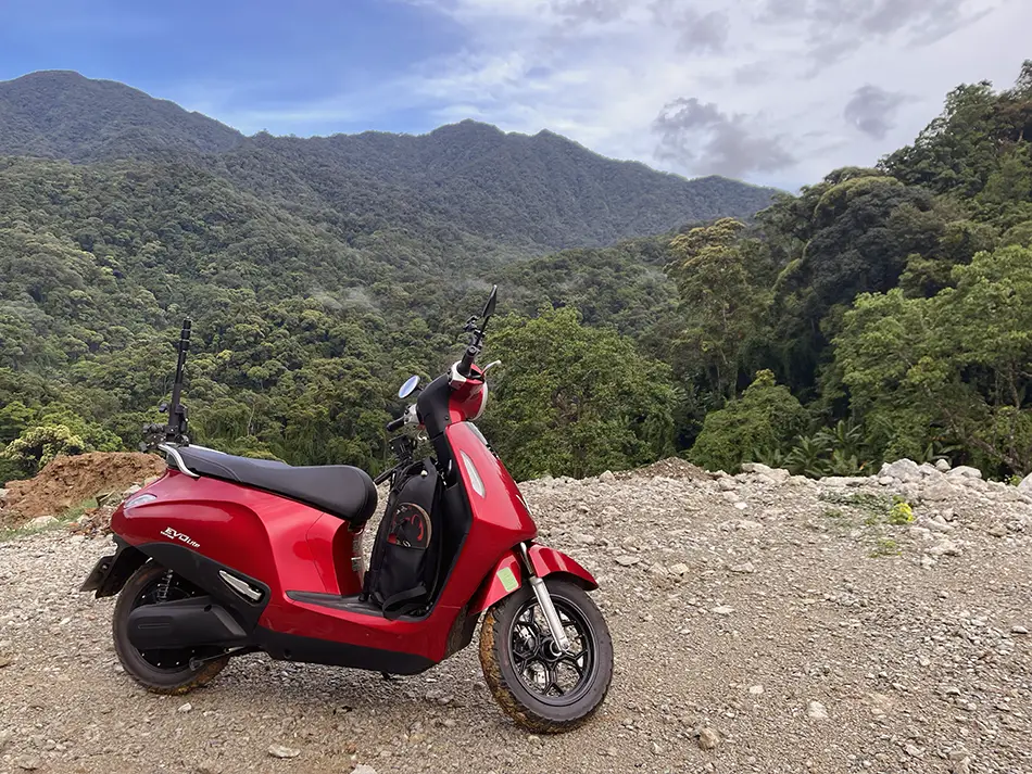
Kham Duc turned out to be a curious town, ringed in mountains, far from anything, but not a backwater — plenty of restaurants. Lots of huge dogs roaming freely. I had to ask three times at the restaurant whether the meat was actually pork. Four local men tried to buy me beer and dinner while I waited for the order.
I made 280 km on the day. Seven swaps, ~$25 spent (658,000 ₫).
Day 15: Kham Duc → Hoi An — a Jungle Reservoir and a Covered Bridge
June 13, 2026
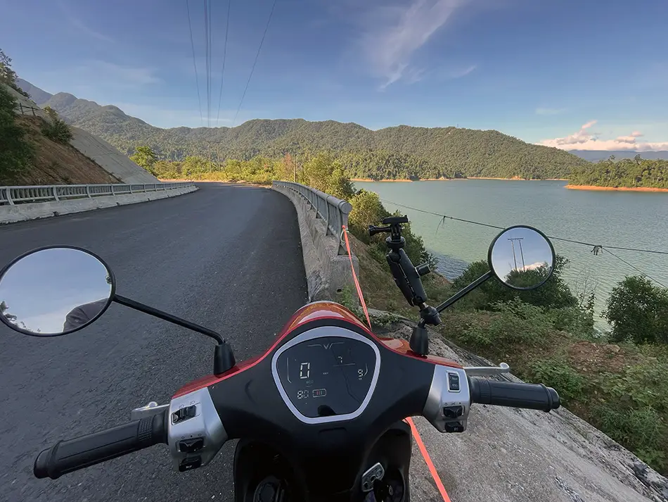
| Start: Kham Duc | Finish: 📍Hoi An |
|---|---|
| Distance | 115 km (71 mi) |
| Total distance | 2,614 km (1,624 mi) |
| Battery swaps | 2 |
| Spend | 791,000 ₫ (~$30.08) |
| Road quality | 2/5 |
| Scenery | 8/10 |
Scenery: Colossal jungle-clad mountains with liana-wrapped tree trunks, a huge reservoir behind a dam, small towns baking in noon heat, rice fields cut through with concrete paths, and a covered wooden bridge in an ancient riverside town.
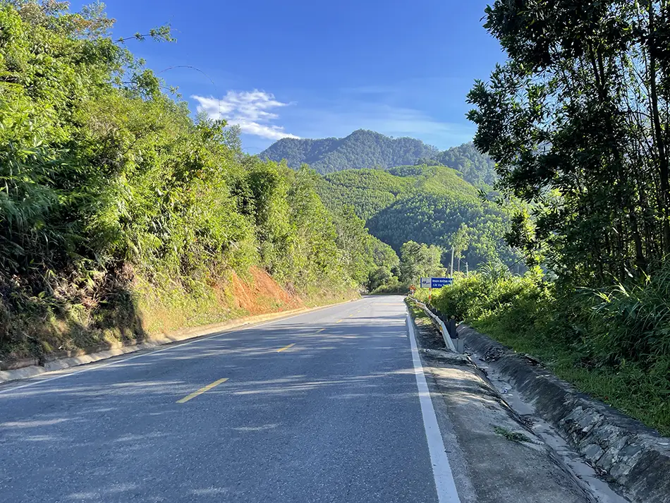
The first 20 km out of Kham Duc on the QL14E were something else. Huge reservoir behind a dam, mountains covered in wild green, road under repair with perfect pavement in some places and torn to pieces in others.
Peaks on both sides, tree trunks so wrapped in lianas that they looked like green columns rather than trees.
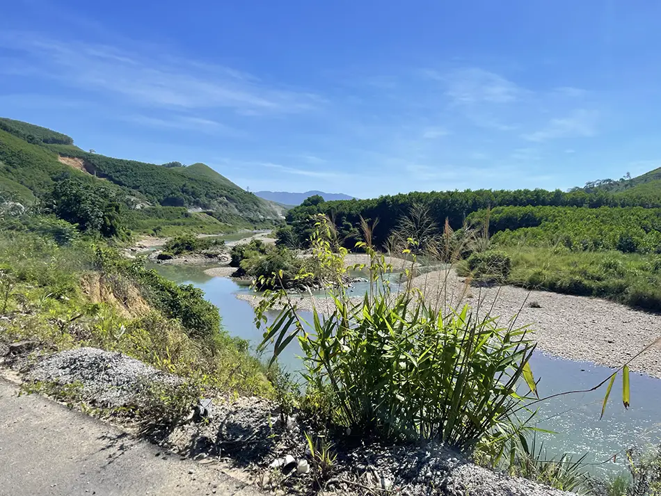
After the first swap the road slid into small towns and dense truck traffic. By 10 in the morning it was baking hot. Two-lane highway through villages, trucks lurching in from side roads, comfortable enough to survive but not much more.
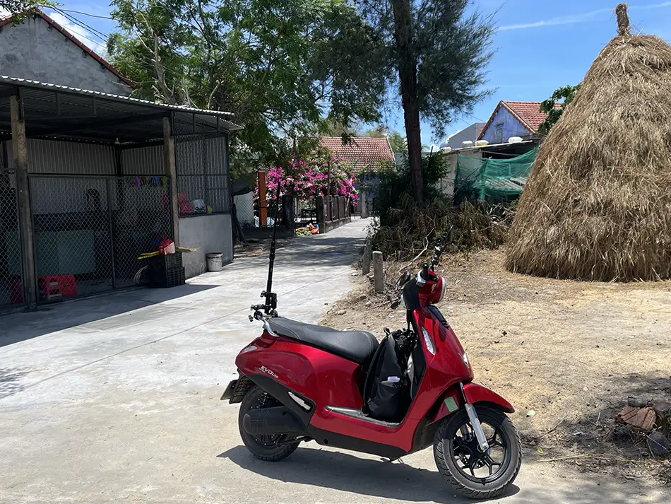
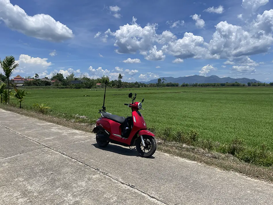
Approaching Hoi An, I had to spend 15 minutes on the QL1A national highway — unpleasant. Turned off at the 📍first opportunity onto a concrete track through rice fields, mountains behind me, humidity punchy from the water in the paddies. Wandered through the narrow lanes of a commune near town for a while, then rolled into Hoi An itself.
The town’s traffic is dense but doesn’t feel hostile. Realised only after arriving that it was a weekend, and Hoi An, is full on weekends. Luckily i still managed to find a decent room in the city center, five minutes’ walk from the Japanese covered bridge.
The bigger shock in 📚Hoi An was the sudden crowd of foreign tourists. Days along the western frontier had accustomed me to almost nobody being around, and coming into a real tourist town felt like a re-adjustment.
Stopped at a scooter service for a repair. The kickstand sensor had been misfiring again since the Phan Thiet, and the brake lever needed replacing (Don’t ask me why). ~$7 for both. Fair.
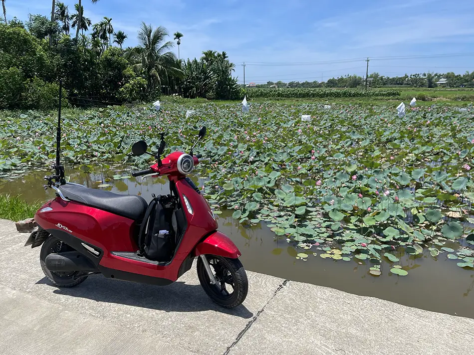
I made 115 km on the day. Two swaps, ~$30 spent (791,000 ₫). Weekend hotel and urgent laundry pushed the day higher than usual.
Day 16: Hoi An → Hue — a Coastal Mountain Pass and Temple-like Tombs
June 14, 2026

| Start: Hoi An | Finish: 📍Hue |
|---|---|
| Distance | 183 km (114 mi) |
| Total distance | 2,797 km (1,738 mi) |
| Battery swaps | 5 |
| Spend | 674,000 ₫ (~$25.63) |
| Road quality | 4/5 |
| Scenery | 8/10 |
Scenery: An old lantern town at sunrise, city streets by the sea, a mountain pass climbing above the coast with bays visible far below, the largest lagoon in Southeast Asia with aquaculture rigs on the water, a peninsula where every grave is built like a small temple, and an imperial city at the end of the day.
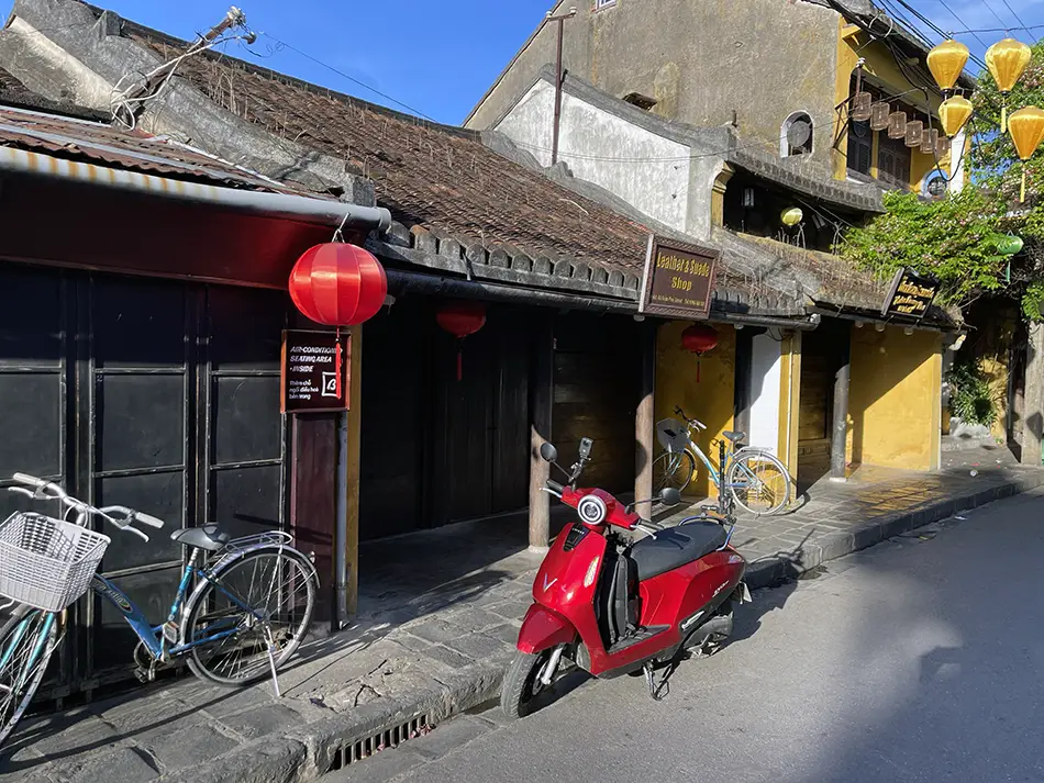
Left Hoi An at 6:30, before the crowds arrived. The old town was already full of Vietnamese women in áo dài dresses for morning photo sessions, but the foreigners were mostly still asleep. Beautiful town, too crowded even at dawn.
There is no way to avoid the main highway on this stretch, but at that time of morning the road nearest to the sea turned out to be almost empty — a lucky ride, and it is not really a coastal road, just the closest to it. Inside Da Nang itself the route runs along the beach: busy, but the flow is comfortable.
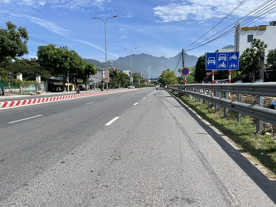
Then it merges back with the highway and you sit in the mid-morning crush until most of the cars peel off into the Hai Van tunnel. What is left starting the climb is what the tunnel does not accept: tourist cars, motorbikes, and gasoline trucks.
The 📍Hai Van pass (Đèo Hải Vân) went smoothly. Two rules on the climb: do not brake, and give the scooter two proper rests of about 10 minutes each — a café with a view is the perfect place for them.
Skipped the summit itself. I have been there many times and the weekend had it packed with tour cars.
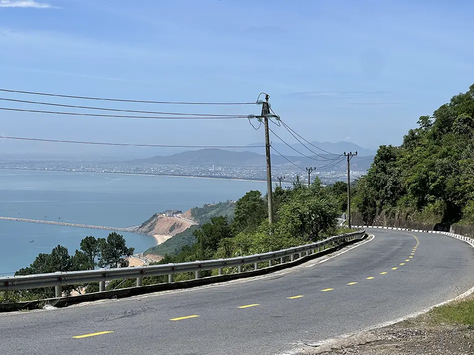
On the descent I ran a small experiment. Released the throttle, tried not to touch the brakes unless absolutely necessary, and watched to see how much charge I could actually recover from the regenerative braking system that the manufacturer advertises. Started at 67%. Over the whole descent the reading dipped to 66% and climbed back to 67%, never touched 68%.
Honestly I do not know what that was. Could be the regen really is that weak. Could be the display just jitters plus or minus one percent while nothing actual is happening. Could be that regen is either non-existent or quietly disabled on this scooter.
I am not technical enough to say. My practical conclusion for the rest of the trip: I will not plan any route counting on regenerative charge, especially in the far north where it is all mountains.
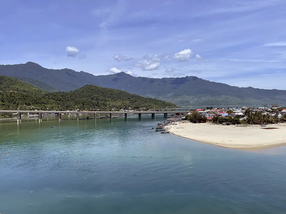
Views on the descent were of course fantastic. But once that aesthetic paradise ends, you are forced back to meet the highway. Twenty-five kilometers of the QL1A national highway followed, unavoidable — trucks and buses hammering the ears.
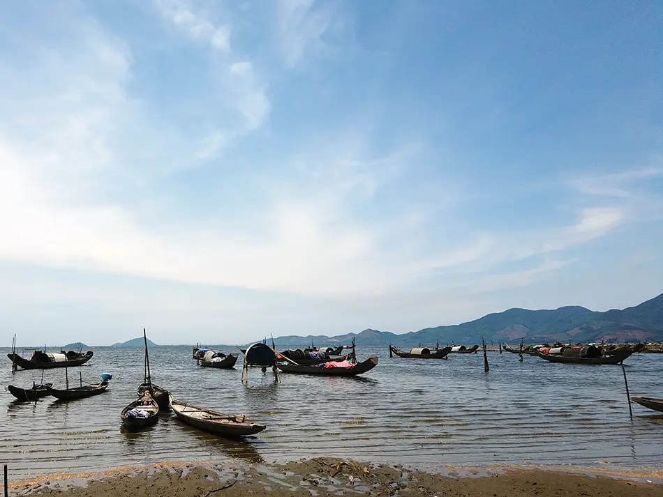
Turned off at the 📍Tam Giang – 📍Cau Hai lagoon (Phá Tam Giang – Đầm Cầu Hai), the largest lagoon in Southeast Asia.
Immediate change of planet: aquaculture rigs sitting on the water, mountains in the background, smooth aesthetic riding.
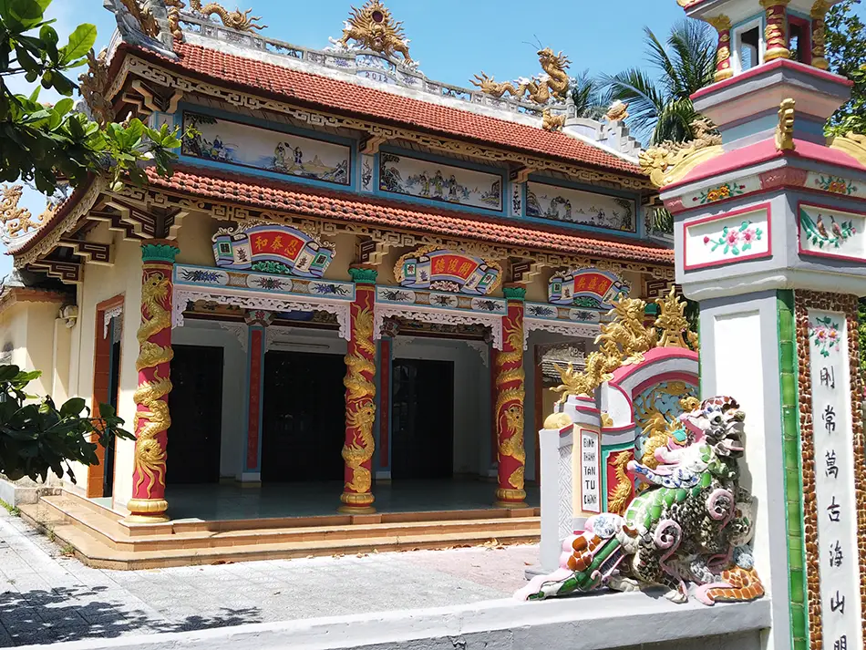
Crossed a long bridge onto the peninsula holding the 📍An Bang (An Bằng) village, locally known as the “City of Ghosts”. On both sides of the road stand extravagant ornate tombs, each built like a small temple, known to be funded by Vietnamese emigrants for their ancestors. Unique in Vietnam.
The rest was road and a bit of Hue city traffic to the hotel and an evening ride to the sunset spot 📍Vong Canh Hill.
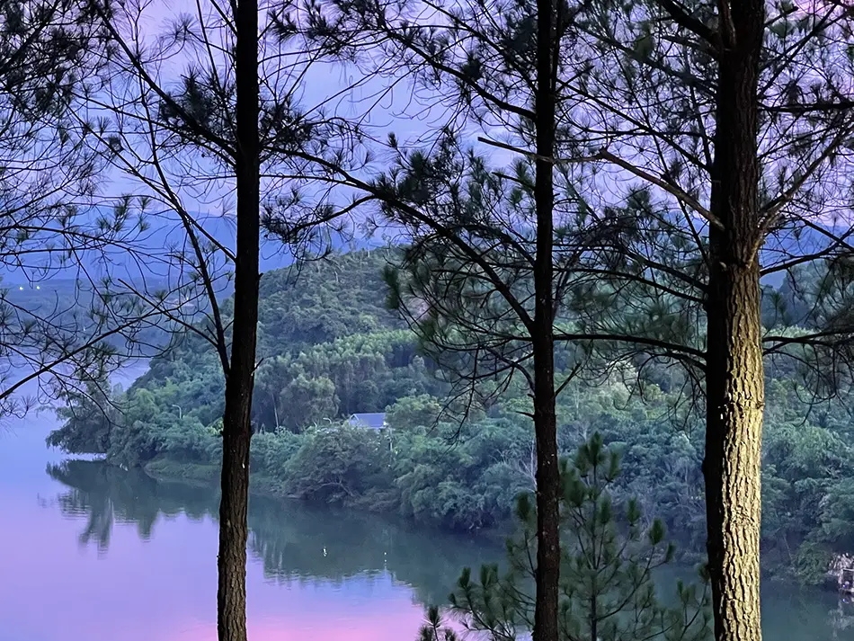
I made 183 km on the day. Five swaps, ~$26 spent (674,000 ₫).
Day 17: Hue → Dong Hoi — Sunrise on a Lagoon and Wartime Tunnels
June 15, 2026
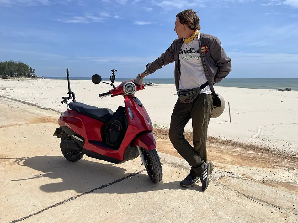
| Start: Hue | Finish: 📍Dong Hoi |
|---|---|
| Distance | 229 km (142 mi) |
| Total distance | 3,026 km (1,880 mi) |
| Battery swaps | 5 |
| Spend | 730,000 ₫ (~$27.76) |
| Road quality | 5/5 |
| Scenery | 7/10 |
Scenery: A lit imperial citadel at dawn, sunrise over a huge freshwater lagoon full of shrimp-farm rigs, labyrinthine village lanes lined with ornate temple-like tombs, lotus and chilli fields, a coastal road running through pines with the sea flashing between the trees, and a cape with camping tents perched on a cliff.
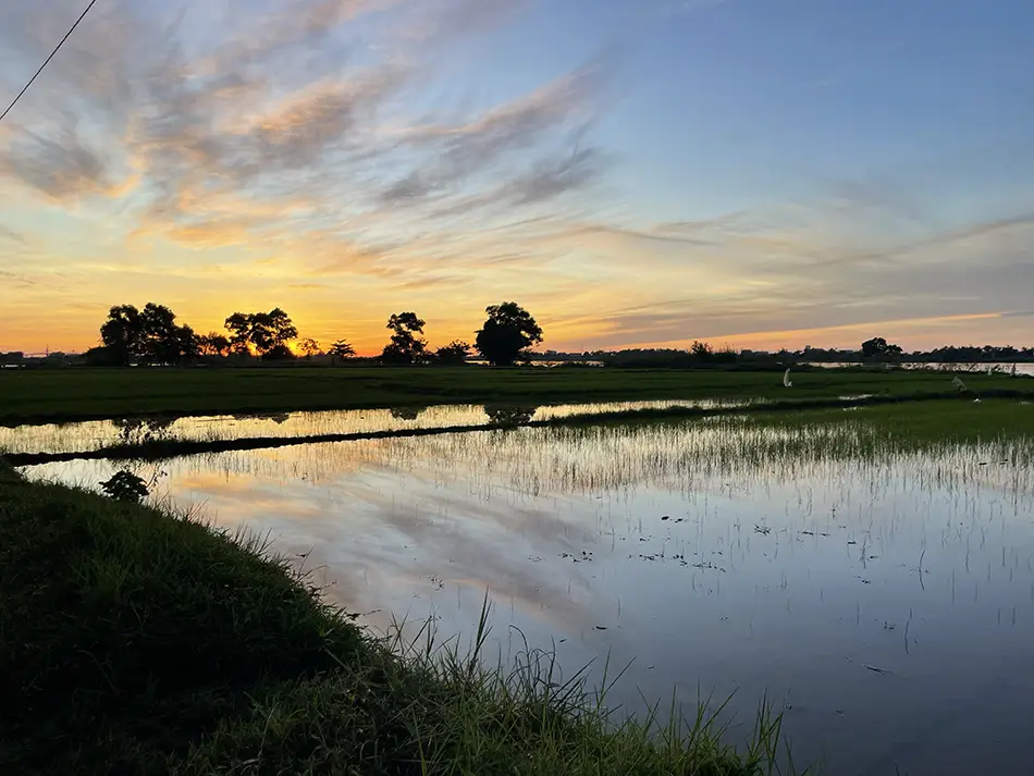
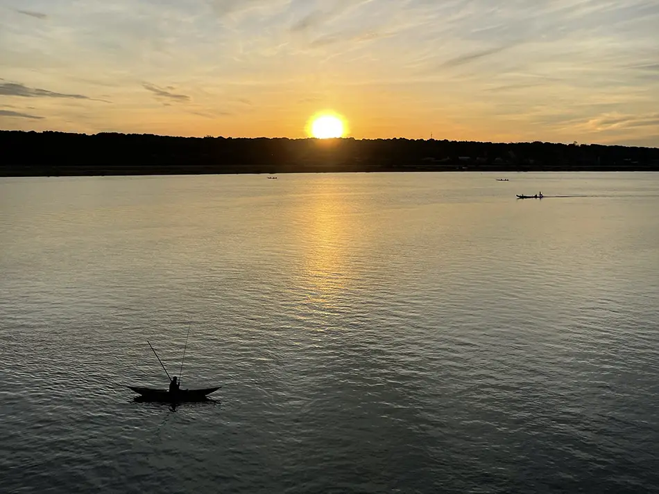
Leaving 📚Hue (Huế) at 5 in the morning was a very good idea. The imperial Citadel was still lit up in the dark, and the streets were empty. Rode toward the 📍Tam Giang lagoon outside the city to catch the sunrise and it was really amazing.

I stayed on the small roads for a long time afterward, winding through the villages that line the water — this is the second stretch in two days where every second house sits beside an ornate ancestor tomb built like a small temple.
Almost ran the battery down, kept turning down another lane in search of another viewpoint.
The stretch from 📍Cua Viet (Cửa Việt) to 📍Cua Tung (Cửa Tùng) made up for it. Empty road, sea flashing through the pines on the right. After Cua Tung the road climbs and the views open up in every direction. Road quality 5/5, traffic almost none.
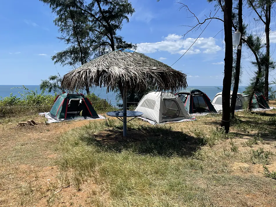
Late breakfast on the 📍Mui Si cape. Pine forest, homestays perched on a cliff with a 180-degree sea view.
They charged $4 for a bowl of instant noodles with some seafood, two times normal, and I could see them working out the price on my face. The view earned it.
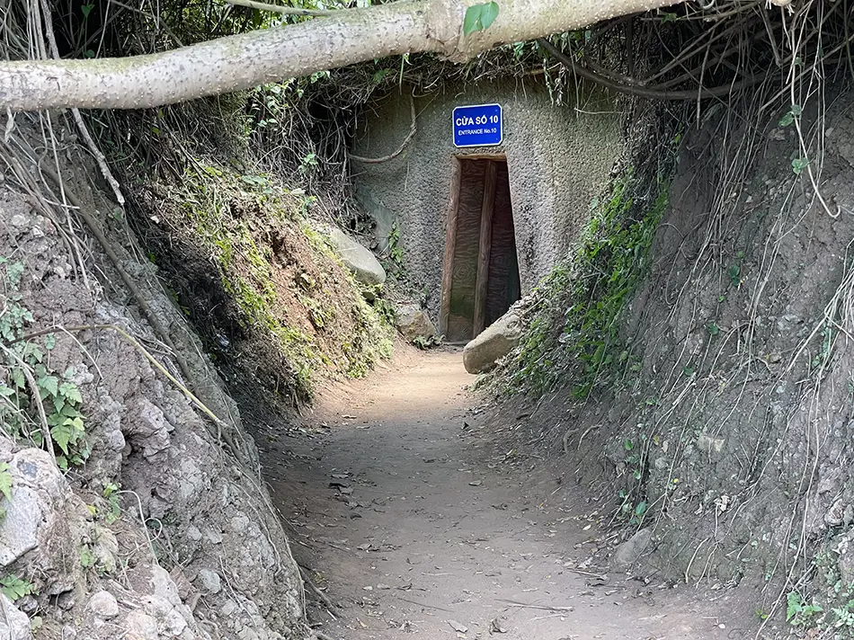
Next, the 📍Vinh Moc tunnels (Địa đạo Vịnh Mốc), where villagers sheltered from American bombing during the war.
More curated than the abandoned tunnels I found near 📚Vung Tau: walkable, with signs.
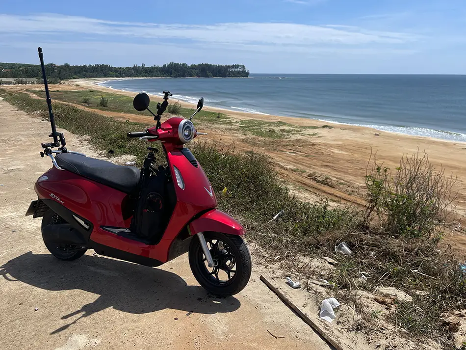
The rest of the day was the QL1A national highway, which in this stretch is surprisingly empty. Some parallel route must be taking the heavy traffic. Crossed the 4,000 km odometer mark somewhere on it. Arrived in Dong Hoi and finished the day with a sunset on the beach.
I made 229 km on the day. Five swaps, ~$28 spent (730,000 ₫).