Spoiler: on our Mount Aragats North Summit hike we didn’t reach the absolute highest point of Armenia. We stopped 38 meters short.
Hard truth: no matter what some tour operators sell you, touching the true highest rock on Aragats is risky and not too easy. We aimed for what the internet called the highest point, and it still wasn’t the true top. The hike was tough, and here is how the day unfolded.
Personal Opinion Warning:
This is a [Story] from a GNS Travel Team member. It reflects the author’s experience and biases. If that’s what you want, enjoy the read. If you need straight facts for hiking Mount Aragats, see our [Guides].
What Is the Highest Mountain in Armenia?
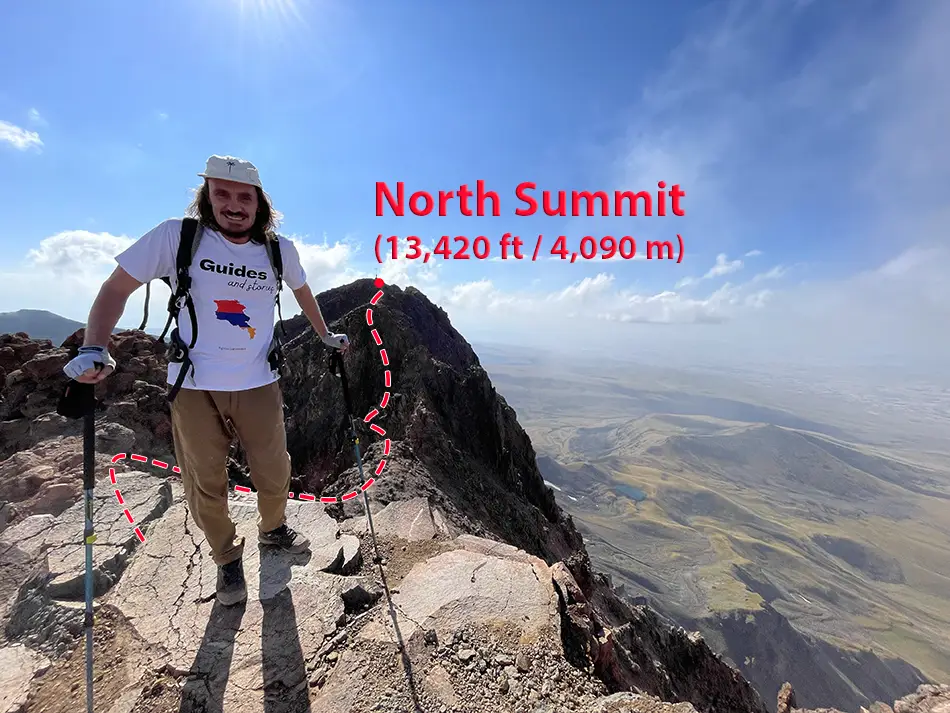
Mount Aragats is Armenia’s highest mountain. It has four summits on the rim of an old crater: North (13,420 ft / 4,090 m), West (13,107 ft / 3,995 m), East (12,822 ft / 3,908 m), and South (12,756 ft / 3,888 m).
Most local tours go to the South summit and sometimes imply it’s “the highest.” If you’re not picky about details, fine—it’s gorgeous and very doable—but it isn’t the highest.
Kari Lake Trailhead for the Aragats North Summit
Kari Lake is the classic trailhead at 10,450 ft (3,185 m). From there you can loop to the South summit, tap the metal trig pyramid, then dip into a small gorge with big views—a great day if you’re not chasing trouble.
But my job with the Guides and Stories travel team is basically to find travel trouble and report back. So of course we aimed for the North summit, unguided.
There is still no mandatory-guide rule here as of August 2025. In too many places, one dramatic incident with independent tourists turns into another regulation. Not here yet. So with my local Armenian friend—who is even less of a hiker than I am—we rented a car and headed from Yerevan toward the highest peak in the country.
Driving From Yerevan to Kari Lake
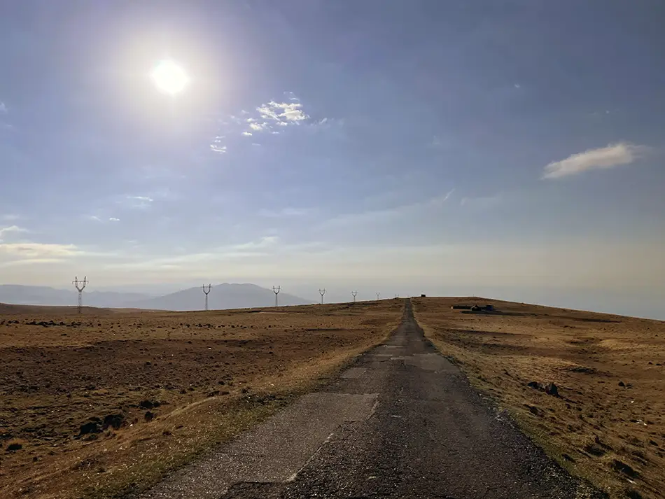
The road itself is fine but skinny and winding; when something’s coming, you squeeze to the mountain or tiptoe the edge. Then there’s the “gravity anomaly.” Probably just an optical effect, but in the moment you don’t care—you roll to neutral, shut the engine, and the car creeps “up.” It’s the strangest feeling, like the mountain is playing with you.
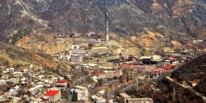
Near Kari Lake, we expected to find the Soviet-era Cosmic Ray Research Station (est. 1943), known for its weird-looking giant magnetic spectrometer—nicknamed the “rail gun to defend from aliens.” Instead, it had been dismantled, and in its place crews were putting up tourist facilities.
The Hike Begins: From Kari Lake to the Aragarts South West Saddle
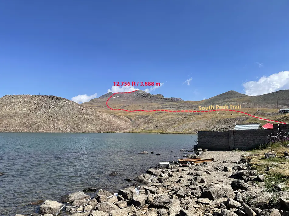
We parked near the lake around 10:00 a.m. (yes, late for a big mountain day), laced up, threw on layers, and set off with Organic Maps as our guide for the Mount Aragats North Summit hike. The first stretch shares the South-summit approach: even a bit of rough road, a few cars, tents by the water, and day hikers aiming for the South. So far so good.
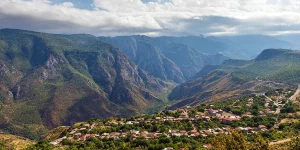
Our path then veered left, skirting the cone toward the saddle between the South and West summits. It wasn’t steep—just a good, high-country walk—and we were already breathing that thinner air. About an hour in we hit roughly 12,140 ft (3,700 m), sat down, and snacked while looking over the high plateau and scattered shepherd camps. The view was wide but hazy; classic Armenian summer.
Into the Crater Toward the North Summit of Armenia’s Highest Mountain
From the saddle’s high point we could see the South and West to the sides of us and finally got a clean look at our target—the North. We dropped into the basin. Trail markings? None. The path faded into stones, came back, vanished again.
What looked straightforward on the map turned into a real-life accordion. A faint sulfur smell drifted on the wind. We hadn’t seen other hikers for a while, which always makes the day feel bigger.
After a short rest by a small glacier creek (tagged “Best source of drinking water” in Organic Maps), we started up again.
My Decathlon boots, which I hate for everything except traction, started skating. We kept trying to stay on what passed for a “trail,” but sections turned into honest scrambling. Some pitches were sheer enough that we used hands on big blocks to keep moving. It wasn’t technical climbing, but falling here could have ended badly.
False Summit Reality and the Exposed Final Ridge
“Remind me why we’re doing the North, not the South?” my friend asked—fair question. He was thinking of our attempt a month earlier on Mount Elbrus, Europe’s highest (18,510 ft / 5,642 m).
Different in scale of toughness, but the overall picture is the same. The southern side is well developed, with a cable car going up to about 12,630 ft (3,850 m), and snowmobiles offering a lift up to 17,388 ft (5,300 m), but we are choosing the northern side, which is wild, with only a simple base camp at about 8,200 ft (2,500 m) and a high camp/refuge with a camping ground at about 12,140 ft (3,700 m).
That time, after spending a week at the high camp waiting for suitable weather, we finished without success. On the summiting day the wind was crazy and made us turn around in the middle of the push.
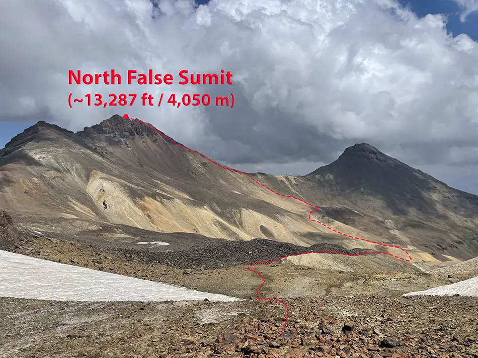
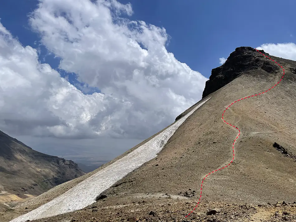
This time, we did “finish”… sort of. The boot-path tops out on a false summit. The real North top sits across a sharp notch. To reach it you have to move along a very exposed ridge where you are climbing with your hands, not just walking. It is short but serious, and a slip could be bad. Without climbing skills and a rope, it felt like an unjustified risk, so we stopped one step shy of the true top.
Descent
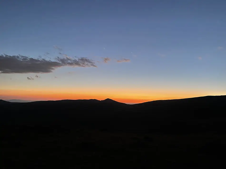
The descent was nastier. It was already 5:00 p.m., and we tried to “save” some up-and-down by contouring on a different line that looked efficient on the map. Endless ball-bearing stones where you ski more than you walk, then a re-ascent on big, wobbly blocks with ankle-snap potential. We caught sunset on the west slope—pretty, but the haze chewed half the color. And there was still distance to walk.
Years ago my instructor gave me the two commandments of day hiking: always carry a rain shell and a headlamp, no matter how easy you think it’ll be. The darkness itself isn’t the problem—the fear of getting stuck in it is. Those words stuck, and our lamps turned a sketchy finish into just a tired one. Toes: bruised. Spirits: surprisingly good. And the night sky? Worth it. With the city lights twinkling far below and the stars punching through, we finally felt the altitude.
Sleep at Kari Lake Car Bivvy or Quick Camp by the Dam
After the descent we had two realistic options for the night: sleep in the car or pitch the tent by the parking. We had no energy for anything else. We grabbed the tent, found a flat but very dusty spot by the dam that borders the parking side of the lake, and crashed. A few hours later we were woken by a big group of tourists from Iran, arriving early—how it’s really meant to be done.
Good to Know
There’s a small guesthouse at Lake Kari these days. We hadn’t booked—we planned to camp—and when we rolled in late it looked closed. If you’re aiming for an overnight before the peak, it can be an option.
Honest Takeaways for the Mount Aragats North Summit Hike
- The North route is a rollercoaster: up to the South–West saddle, down to the crater floor, up to the North summit. Then the same in reverse.
- Views are good—but for me, not “value for energy” good. Totally subjective. If you want a strong day with less drama, the South summit loop from Kari Lake is more than enough.
- Altitude hits. You start around 10,450 ft (3,185 m) and spend hours above 12,000 ft (3,650 m). Expect the tipsy, slow-motion feeling and plan around it.
- What would bring me back? A simple overnight on the caldera floor. Pitch a tent by a glacier creek, let the sky turn black and crowded with stars, sleep high, then launch for the North before dawn. With water around and no signs of restrictions, it feels totally doable.
- Safety note on the “true” North: many hikers stop at the false top for a reason. The real summit requires crossing an airy ridge; people with rope skills treat it as a short but serious scramble. If that’s not you, there’s zero shame in calling the false summit “north enough.”
This is a story, and not a guide by any chance. Some people are known to do the “4 summit runs” here, with a known time record of around 7 hours for all the peaks. For us, one peak back-and-forth took around 9 hours. For someone, even the North Peak alone can be too much. So if you are heading here, think with your head, assess the risks, and remember it’s your responsibility out there—even if you hire a guide.
A little bit of science fiction instead of the conclusion
There’s one thing that made me love this experience beyond the tough hike—which, by day’s end, is its own kind of joy. It felt like diving into a post-Soviet science-fiction set come alive. Think beyond the summit: this place could be a gateway to some wish-granting artifact straight out of the Strugatsky brothers’ Roadside Picnic.
Take the observatory domes, the scattered research buildings, the “gravity” spot where cars seem to climb the hill with the engine off, the “shepherd camps” guarded by bear-sized dogs. What’s missing? A nuclear power plant built by the Soviet Union on the outskirts of its vast territory. Not next to a big city or an industrial zone, but at the edge of nowhere—and yes, there is one!
Put it together and the area reads less like a hiking zone and more like a field site for something they never fully declassified. Even with the “giant magnetic gun” now dismantled, the whole atmosphere still feels like sci-fi if you let your imagination run.
Back from imagination to real life. Within 24 hours of descending, seven old travel buddies messaged me. They were scattered around the world, people I hadn’t spoken to in years. They asked how I was. Several said I had suddenly popped into their heads. Others were remembering trips we’d taken together. I had to laugh. Seven people at once felt like the mountain boosted a small broadcast of me. Call it presence, call it soul—it reached them.
Maybe soon you’ll hear from me organising the “Wishes-Come-True” esoteric, science-fiction hike to the North summit of Mount Aragats. Maybe not…
Stay tuned for more, and have good adventures. For more inspiration on your trip to Armenia, check out our Best Places to Visit list here.